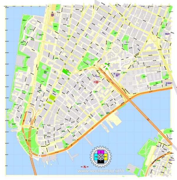
The Financial District (FiDi) in New York City is a historic neighborhood located at the southern tip of Manhattan. It is renowned as the financial heart of the city and is home to some of the world’s most prominent financial institutions.
The history of the Financial District is rich and dates back to the early days of New Amsterdam, the Dutch colonial settlement that would later become New York.
Vectormap.Net provide you with the most accurate and up-to-date vector maps in Adobe Illustrator, PDF and other formats, designed for editing and printing. Please read the vector map descriptions carefully.
Historical Overview:
- Colonial Era:
- The Financial District’s roots trace back to the 17th century when the Dutch established New Amsterdam in the early 1600s. The southern tip of Manhattan was used for trading and commerce.
- British Occupation:
- After the British seized control in 1664, the area continued to thrive as a trading hub. Merchants and traders gathered around the waterfront, leading to the establishment of the New York Stock Exchange (NYSE) in 1792 under a buttonwood tree at 68 Wall Street.
- 19th Century Growth:
- The Financial District expanded during the 19th century, witnessing the construction of iconic buildings like the New York Stock Exchange, the U.S. Custom House, and the Alexander Hamilton U.S. Custom House.
- 20th Century and Beyond:
- The Financial District maintained its status as the financial center of the world throughout the 20th century. In the aftermath of the September 11 attacks in 2001, the district underwent significant reconstruction and revitalization.
Transportation Infrastructure:
- Subway:
- The Financial District is well-connected through the New York City subway system. Major subway lines serving the area include the 1, 2, 3, 4, 5, J, Z, R, and W trains, providing easy access to other parts of Manhattan and the outer boroughs.
- Bus Services:
- Various bus routes, operated by the Metropolitan Transportation Authority (MTA), serve the Financial District, offering additional transportation options.
- Ferries:
- Due to its proximity to the waterfront, the Financial District has several ferry terminals. The Staten Island Ferry and ferries to New Jersey provide commuters with scenic and efficient transportation alternatives.
- Bicycle Infrastructure:
- The Financial District is increasingly bike-friendly, with bike lanes and Citi Bike stations available. Biking has become a popular mode of transportation, offering a convenient way to navigate the neighborhood.
- Pedestrian-Friendly Environment:
- The Financial District has undergone urban planning initiatives to enhance its pedestrian-friendly environment. Efforts include the creation of plazas, such as Zuccotti Park, providing public spaces for relaxation and community engagement.
- Iconic Structures:
- The Financial District is home to iconic structures like the One World Trade Center (Freedom Tower), the Battery Park City esplanade, and the Charging Bull sculpture, which have become integral parts of the neighborhood’s identity.
The history and transportation infrastructure of the Financial District reflect its evolution from a colonial trading post to a global financial powerhouse, seamlessly blending historical significance with modern functionality.


 Author: Kirill Shrayber, Ph.D. FRGS