Map Dundee UK for Printing

Printable Map — Dundee UK

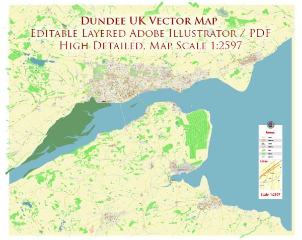
A production‑ready printable map of Dundee UK built for clear labeling and predictable output across sizes. The file accepts custom grids, legends and callouts without redrawing base content. Typography spacing is tuned for quick reading on posters, brochures and reports. District and neighborhood labels are arranged to avoid collisions around dense cores. Layer structure separates arterials and locals, districts, hydrography, parks and landmarks. Bridges, tunnels and ferry lines are isolated so routes remain legible after recolor.

Works well as an underlay for wayfinding, transport schemes and editorial layouts. Ideal for signage, event maps, campus leaflets and waterfront brochures. Color systems can be swapped quickly to match seasonal or brand variants. Keeps labels readable while allowing deep customization of routes and highlights. The map integrates neatly with common DTP and GIS workflows.

The coordinates for Dundee, UK, as well as some general information. Vectormap.Net provide you with the most accurate and up-to-date vector maps in Adobe Illustrator, PDF and other formats, designed for editing and printing. Please read the vector map descriptions carefully.

Coordinates:

  • Latitude: 56.4620° N
  • Longitude: 2.9707° W

Total Area: Dundee covers an area of approximately 60 square kilometers.

Main Streets and Roads: Some of the main streets and roads in Dundee include:

  1. High Street: A historic street in the city center with shops, restaurants, and cultural attractions.
  2. Nethergate: Another important street in the city center, known for its shops, bars, and cafes.
  3. Perth Road: A major road running through the west end of Dundee, featuring shops, restaurants, and residential areas.
  4. Kingsway: A significant dual-carriageway road that forms a semi-circular ring road around the city.
  5. Riverside Drive: Running along the banks of the River Tay, Riverside Drive provides scenic views and connects various parts of the city.

For the most up-to-date and detailed information, it is recommended to check with local sources or use online mapping services. Keep in mind that developments and street names can change over time.

Author: Kirill Shrayber, Ph.D.

I have been working with vector cartography for over 25 years, including GPS, GIS, Adobe Illustrator and other professional cartographic software.
Linkedin: https://www.linkedin.com/in/kirill-shrayber-0b839325/
Twitter: https://twitter.com/vectormapper

Are we missing some maps? Let us know!!!
What map do you need?

    We will upload it within the next 24 hours and notify you by Email.

    Menu