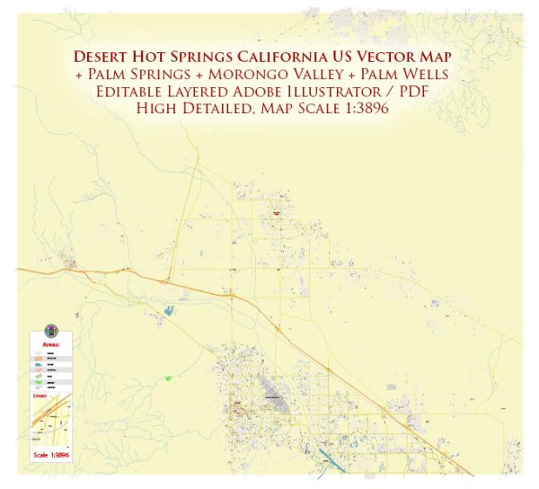
A general overview of the economic and transport connections between Desert Hot Springs and Palm Springs in California, USA.
Vectormap.Net provide you with the most accurate and up-to-date vector maps in Adobe Illustrator, PDF and other formats, designed for editing and printing. Please read the vector map descriptions carefully.
Economic Overview:
Desert Hot Springs:
- Economic Base: Desert Hot Springs is a city located in Riverside County, California. Historically known for its natural hot mineral springs, the city has sought to develop its tourism sector. Additionally, there are residential and commercial developments in the area.
- Tourism: The city has attracted visitors seeking relaxation and wellness due to its natural hot springs. Tourism-related businesses, including resorts, spas, and hotels, play a significant role in the local economy.
- Employment: Employment opportunities in Desert Hot Springs include those in the hospitality and service industries, as well as retail and construction.
Palm Springs:
- Economic Base: Palm Springs is a well-known resort city in Riverside County, California, and is a part of the Coachella Valley. It is a major tourist destination, known for its mid-century modern architecture, cultural events, and outdoor recreation.
- Tourism: Palm Springs is a popular destination for tourists, especially those seeking a desert retreat. The city offers a range of amenities, including hotels, restaurants, shopping, and various cultural events and festivals.
- Real Estate: The real estate market in Palm Springs includes both residential and vacation properties. The city’s architecture and climate make it attractive to both full-time residents and second-home owners.
Transport Connections:
Road Transportation:
- Highways: Both Desert Hot Springs and Palm Springs are accessible via Interstate 10 (I-10), a major east-west highway. Additionally, Highway 62 connects Desert Hot Springs to other parts of the region.
- Local Roads: Local road networks provide connectivity within each city and to surrounding areas. In Palm Springs, roads like Palm Canyon Drive are significant for local businesses and tourism.
Public Transport:
- Bus Services: Public bus services, such as SunLine Transit Agency, operate in the region, providing transportation within cities and connecting them to neighboring communities.
Air Transportation:
- Airports: Palm Springs International Airport serves the region, providing domestic and limited international flights. It is a key transportation hub for tourists visiting Palm Springs and the surrounding areas.
Conclusion:
Desert Hot Springs and Palm Springs are interconnected through road networks and share common economic ties related to tourism. Both cities benefit from their proximity to each other, contributing to the overall appeal of the Coachella Valley as a tourist destination. The economic activities in these cities are closely tied to the hospitality, real estate, and service industries, with tourism playing a pivotal role in their development. Keep in mind that the economic and transportation landscapes can evolve, so it’s recommended to check for the latest updates for the most accurate information.


 Author: Kirill Shrayber, Ph.D.