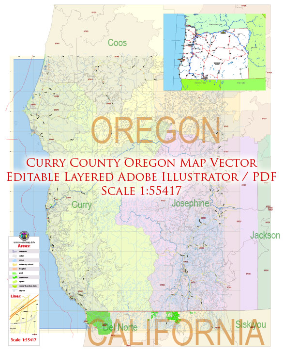
Vector Maps of the Curry County : Southwestern-most county in the U.S. state of Oregon. The county seat is Gold Beach. The county is named for George Law Curry, a two-time governor of the Oregon Territory. Curry County includes the Brookings, OR Micropolitan Statistical Area.
Area: 5,149 km²
Founded: 1855
Instant download archives: royalty free, editable vector maps of Curry County Oregon in high resolution digital PDF and Adobe Illustrator format.
Information on the transportation infrastructure of Curry County, Oregon. Infrastructure details can change over time due to construction projects, upgrades, or other developments.
Vectormap.Net provide you with the most accurate and up-to-date vector maps in Adobe Illustrator, PDF and other formats, designed for editing and printing. Please read the vector map descriptions carefully.
A general overview of what transportation infrastructure might include in a county:
- Roads and Highways:
- Curry County likely has an extensive network of roads and highways connecting its communities. Major highways and state routes passing through or near the county may facilitate transportation both within the county and to neighboring areas.
- Public Transportation:
- Public transportation options may include bus services, shuttles, or other forms of communal transit. It’s important to check with local transit authorities for details on routes, schedules, and available services.
- Airports:
- Curry County may have airports or airstrips to facilitate air travel. The type and size of airports can vary, ranging from small regional airports to larger facilities.
- Ports and Harbors:
- If the county has access to the ocean or rivers, there may be ports or harbors supporting maritime transportation. These facilities are crucial for shipping goods and supporting the local economy.
- Bridges and Tunnels:
- Significant water bodies may be crossed by bridges or tunnels, connecting different parts of the county. Maintenance and improvements to these structures are essential for ensuring safe and efficient transportation.
- Railroads:
- While rail infrastructure might not be as extensive in some rural counties, there could be rail lines serving transportation needs for goods or passengers.
- Cycling and Pedestrian Infrastructure:
- The county might have dedicated infrastructure for cyclists and pedestrians, such as bike lanes, sidewalks, and pedestrian-friendly pathways.
- Infrastructure Planning and Development:
- Local authorities and transportation departments likely engage in ongoing planning and development to address the changing needs of the community. This can involve road maintenance, expansion projects, and improvements to enhance overall transportation efficiency and safety.
For the latest and most accurate information, please check with Curry County’s official government websites, transportation departments, or other relevant local sources.
All of our editable Curry County Oregon vector maps are digital files,
which can be instantly downloaded in editable PDF or Adobe Illustrator format.
Objects on maps are usually divided into layers according to their types – lines, polygons, street names, object names (see map description!!!!)
Each of our Curry County Oregon digital maps is available in Adobe Illustrator or editable PDF format, (or on request in any other known format for the same price)
which use a vector approach to display images,
you can easily enlarge any part of our maps without compromising text, line or graphic quality,
with any increase or decrease ratio.
Using a vector graphics editor such as Adobe Illustrator, CorelDraw, Inkscape, or Freehand
you can easily crop parts of the map, add custom characters, and change colors and font attributes as needed.
We have a variety of Curry County Oregon vector maps with different levels of detail, from simple empty paths to highly detailed maps with roads and terrain layers.
Don’t see exactly what you’re looking for? Contact us to receive a special offer for an individual Curry County Oregon map for your project.


 Author: Kirill Shrayber, Ph.D. FRGS