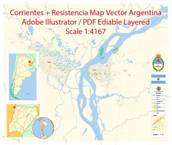
Corrientes and Resistencia are two neighboring cities located in northeastern Argentina, and they are both capitals of their respective provinces. The provinces are Corrientes and Chaco.
Vectormap.Net provide you with the most accurate and up-to-date vector maps in Adobe Illustrator, PDF and other formats, designed for editing and printing. Please read the vector map descriptions carefully.
Let’s explore the economic and transport connections between Corrientes and Resistencia:
Economic Connections:
- Trade and Commerce:
- Both cities are important economic centers in the region, contributing significantly to the economic development of their respective provinces.
- The trade between Corrientes and Resistencia involves various goods and services, including agricultural products, manufactured goods, and services.
- Agriculture:
- The economies of both provinces are closely tied to agriculture. They produce crops such as soybeans, cotton, and citrus fruits.
- Agricultural activities in the region contribute to the local economies and serve as a basis for agro-industrial development.
- Tourism:
- The region, with its natural attractions and cultural heritage, attracts tourists. Both cities likely benefit from tourism-related activities, including hospitality, restaurants, and entertainment.
- Industry:
- Industrial activities contribute to the economic growth of the region. Manufacturing and processing industries may be present, especially in areas related to agriculture.
Transport Connections:
- Roadways:
- Corrientes and Resistencia are connected by a network of roads and highways, facilitating the movement of goods and people between the two cities.
- The National Route 12 connects the two cities and is an essential transport artery in the region.
- Public Transportation:
- Both cities likely have local public transportation systems, such as buses, serving the urban and suburban areas.
- Inter-city bus services may also connect Corrientes and Resistencia, providing a cost-effective means of travel for residents and visitors.
- Air Transport:
- There may be airports in both cities with domestic flights connecting them to other parts of Argentina.
- The General Belgrano International Airport in Resistencia and the Doctor Fernando Piragine Niveyro International Airport in Corrientes may serve as important air transport hubs.
- River Transport:
- The Paraná River, which runs close to both cities, may play a role in transportation, especially for goods. River transport can be crucial for industries and agriculture.
- Rail Connections:
- Railways may also connect Corrientes and Resistencia, providing additional options for transporting goods and passengers.
It’s important to note that the specific details of economic and transport connections can evolve, so it’s advisable to check for the latest information from local sources or official government websites for the most up-to-date details.


 Author: Kirill Shrayber, Ph.D.