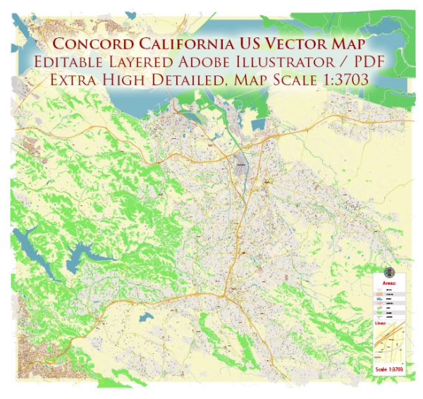
Concord, California, located in Contra Costa County, has a rich history that dates back to the 19th century. The city’s development and road system have evolved significantly over the years.
Vectormap.Net provide you with the most accurate and up-to-date vector maps in Adobe Illustrator, PDF and other formats, designed for editing and printing. Please read the vector map descriptions carefully.
Historical Overview:
- Early Settlement and Agriculture (1800s):
- The area that is now Concord was initially inhabited by the Miwok Native American people.
- In the 19th century, the region saw Spanish and Mexican land grants, leading to the establishment of ranchos.
- The town of Pacheco, one of Concord’s predecessors, was founded in 1868.
- Founding and Incorporation (1900s):
- The town of Concord was founded in 1869 by Salvio Pacheco.
- The arrival of the railroad in the late 19th century boosted economic development.
- Concord was incorporated as a city on February 5, 1905.
- Military Presence (20th Century):
- During World War II, the Concord Naval Weapons Station was established, contributing to the city’s growth.
- The military presence played a crucial role in Concord’s development during the mid-20th century.
- Post-War Suburbanization:
- Like many other areas in the United States, Concord experienced significant suburbanization in the post-World War II era.
- The population increased as housing developments and infrastructure expanded.
Road System:
- Early Roads:
- In the 19th century, basic roads connected Concord to neighboring towns and regions.
- The development of roadways was crucial for agricultural transportation and local commerce.
- Railroads:
- The arrival of the railroad in the late 1800s enhanced transportation connectivity.
- Railroads facilitated the movement of goods and people, contributing to economic development.
- Automobile Era:
- With the rise of the automobile in the early 20th century, Concord’s road system underwent transformations.
- The construction of highways and roads became essential for accommodating the increasing number of vehicles.
- Interstate 680:
- Interstate 680, a major north-south freeway, runs through Concord, connecting it to other parts of the San Francisco Bay Area.
- The construction of I-680 played a pivotal role in regional transportation.
- City Planning and Development:
- Concord’s road system evolved with city planning initiatives to accommodate the growing population.
- The city’s infrastructure development aimed at providing efficient transportation and connectivity.
- Modern Challenges and Solutions:
- In recent years, the city has faced challenges related to traffic congestion and urban planning.
- Initiatives such as road expansions, public transportation improvements, and traffic management have been implemented to address these issues.
Today, Concord stands as a thriving suburban city with a diverse population and a well-connected road system that reflects its historical evolution and adaptation to the changing needs of the community. Ongoing urban planning and infrastructure projects continue to shape Concord’s transportation landscape.


 Author: Kirill Shrayber, Ph.D.