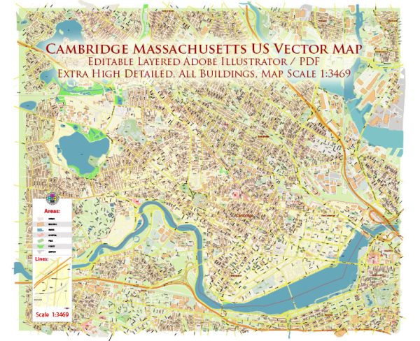
Cambridge, Massachusetts, has a rich history dating back to its founding in 1630. A brief overview of the city’s history and its road system.
Vectormap.Net provide you with the most accurate and up-to-date vector maps in Adobe Illustrator, PDF and other formats, designed for editing and printing. Please read the vector map descriptions carefully.
History of Cambridge:
- Early Settlement:
- Founded in 1630, Cambridge was originally known as “Newe Towne” and served as a prominent colonial settlement.
- The city was named after the University of Cambridge in England, reflecting the educational aspirations of its early residents.
- Educational Hub:
- Harvard University, one of the world’s most prestigious institutions, was established in Cambridge in 1636. The university has played a significant role in shaping the city’s identity.
- Revolutionary War:
- During the American Revolutionary War, Cambridge served as the headquarters of George Washington and the Continental Army in 1775-1776.
- Notable events such as the Battle of Bunker Hill and the Siege of Boston took place in the vicinity.
- Industrialization and Growth:
- In the 19th century, Cambridge experienced industrialization and urbanization, attracting diverse communities and contributing to its economic growth.
- Incorporation as a City:
- Cambridge was incorporated as a city in 1846, separating from the town of Cambridge (present-day Arlington).
- Innovation Hub:
- In the 20th and 21st centuries, Cambridge became a hub for innovation and technology, hosting numerous biotech and IT companies. Kendall Square, in particular, is renowned for its concentration of life sciences and tech firms.
Road System:
- Street Grid:
- Cambridge’s street grid is characterized by a mix of colonial-era winding roads and a more modern, organized grid.
- Notable roads include Massachusetts Avenue, which traverses the city from northwest to southeast, connecting Harvard Square to the MIT area.
- Harvard Square:
- Harvard Square, a historic and vibrant area, is a focal point of the city with a complex network of streets and pedestrian-friendly zones.
- Bridges:
- Several bridges connect Cambridge to neighboring Boston, including the Longfellow Bridge and the Massachusetts Avenue Bridge.
- Public Transportation:
- The Massachusetts Bay Transportation Authority (MBTA) provides public transportation, including buses and the Red Line of the subway, connecting Cambridge to Boston and surrounding areas.
- Cycling Infrastructure:
- Cambridge is known for its commitment to sustainability and has developed an extensive network of bike lanes and paths, promoting cycling as a popular mode of transportation.
- Traffic and Parking:
- Like many urban areas, Cambridge faces challenges related to traffic congestion and limited parking. Efforts have been made to improve public transit and encourage alternative transportation modes.
- Historical Preservation:
- The city has preserved many historic sites, and efforts are made to balance modern development with the preservation of its rich history and architecture.
Cambridge’s history and road system reflect a blend of colonial heritage, educational prominence, technological innovation, and urban planning. The city’s commitment to sustainability and accessibility continues to shape its road infrastructure and transportation systems.


 Author: Kirill Shrayber, Ph.D. FRGS