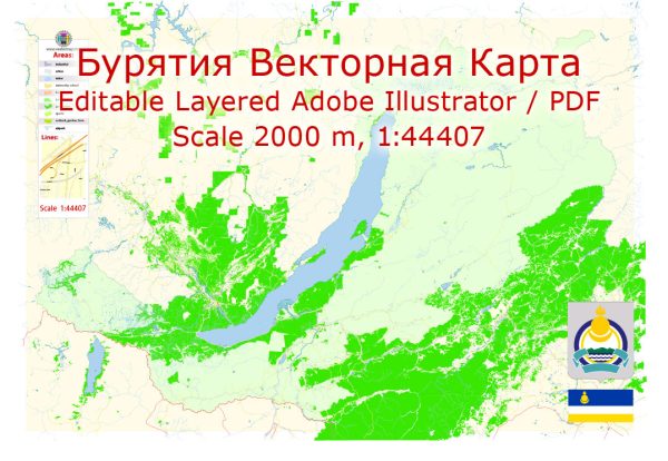
Buryatia is a federal subject of Russia located in Siberia, on the eastern side of Lake Baikal. It is an autonomous republic with a predominantly ethnic Buryat population. The political and economic history of Buryatia is closely tied to broader Russian and Soviet histories.
Vectormap.Net provide you with the most accurate and up-to-date vector maps in Adobe Illustrator, PDF and other formats, designed for editing and printing. Please read the vector map descriptions carefully.
Political History:
- Pre-Soviet Era (Before 1917): Buryatia was historically inhabited by the Buryat people, who have a rich cultural and nomadic heritage. The region fell under the influence of the Mongol Empire in the 13th century and later became part of the Russian Empire in the 17th century. The Buryats were largely pastoral nomads, and their way of life was impacted by Russian colonization.
- Soviet Era (1917-1991): After the Russian Revolution of 1917, the Bolsheviks established control over the territory. Buryatia initially became part of the Russian Soviet Federative Socialist Republic (RSFSR) and later, in 1923, an autonomous oblast within the RSFSR. In 1937, it was reorganized as the Buryat-Mongol Autonomous Soviet Socialist Republic. The Buryats, like many other ethnic groups, experienced the policies of cultural assimilation and collectivization under Soviet rule.
- Post-Soviet Era (1991-Present): With the dissolution of the Soviet Union in 1991, Buryatia became a federal subject of the Russian Federation. It retained its status as an autonomous republic within the framework of the Russian Federation. The post-Soviet period saw efforts to revive and preserve Buryat culture, language, and traditions. The region has also faced challenges related to economic restructuring and the transition to a market economy.
Economic History:
- Pre-Soviet Economy: Before the Soviet era, Buryatia’s economy was primarily based on traditional nomadic pastoralism, hunting, and fishing. The region’s resources, including timber and minerals, were also utilized to some extent.
- Soviet Industrialization: Under Soviet rule, there was a significant push for industrialization. Buryatia saw the development of industries such as mining, forestry, and agriculture. Lake Baikal became a focus for hydroelectric power production, leading to the construction of the Irkutsk Hydroelectric Power Station.
- Post-Soviet Economic Challenges: The collapse of the Soviet Union had a profound impact on the economy of Buryatia. The transition to a market economy brought both opportunities and challenges. Many Soviet-era industries faced difficulties, and there was a need for economic diversification. The region has sought to develop sectors such as tourism, agriculture, and small and medium-sized enterprises to spur economic growth.
- Natural Resources: Buryatia is rich in natural resources, including minerals, timber, and freshwater resources from Lake Baikal. Exploiting these resources sustainably while protecting the environment has been a key consideration in the economic development of the region.
In recent years, Buryatia has been working on fostering economic growth, preserving its cultural heritage, and addressing the challenges associated with regional development in the context of the broader Russian Federation.


 Author: Kirill Shrayber, Ph.D.