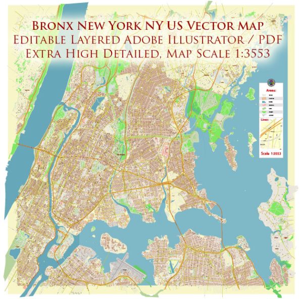
The transportation infrastructure in the Bronx, New York, is an integral part of the larger New York City transportation network.
Vectormap.Net provide you with the most accurate and up-to-date vector maps in Adobe Illustrator, PDF and other formats, designed for editing and printing. Please read the vector map descriptions carefully.
- Roads and Highways:
- The Bronx is well-connected to the rest of New York City and the surrounding areas through an extensive network of roads and highways. Major arteries include the Bronx River Parkway, Cross Bronx Expressway (I-95), Bruckner Expressway (I-278), and the Major Deegan Expressway (I-87).
- Public Transit:
- Subway: The New York City Subway system has multiple lines serving the Bronx. The numbered lines (1, 2, 4, 5, 6) and the lettered lines (B, D) provide extensive coverage throughout the borough.
- Bus Services: The Metropolitan Transportation Authority (MTA) operates a comprehensive bus network connecting various neighborhoods within the Bronx and linking to other boroughs.
- Rail Services:
- The Metro-North Railroad serves the Bronx with multiple lines, including the Harlem Line and the Hudson Line. These lines connect the Bronx to other parts of New York State and Connecticut.
- Bridges and Tunnels:
- Several bridges and tunnels connect the Bronx to Manhattan and other parts of the city. Examples include the Robert F. Kennedy Bridge (formerly the Triborough Bridge), the Henry Hudson Bridge, and the Bronx-Whitestone Bridge.
- Airports:
- While the Bronx itself does not have a major airport, it is in close proximity to both LaGuardia Airport and John F. Kennedy International Airport, which serve domestic and international flights.
- Biking and Pedestrian Infrastructure:
- The Bronx has been working on improving biking and pedestrian infrastructure. The borough has a network of bike lanes, and efforts have been made to enhance walkability in certain areas.
- Ferries:
- The Bronx has limited ferry service. The NYC Ferry system connects Soundview in the Bronx to Manhattan, providing an alternative mode of transportation along the East River.
- Future Developments:
- The transportation landscape is subject to ongoing changes and improvements. Projects and initiatives aimed at enhancing public transportation, reducing traffic congestion, and improving connectivity are often underway. It’s advisable to check for the latest updates on infrastructure developments in the Bronx.
For the most current and detailed information, you may want to consult local transportation authorities, such as the Metropolitan Transportation Authority (MTA) and the New York City Department of Transportation (NYCDOT).


 Author: Kirill Shrayber, Ph.D. FRGS