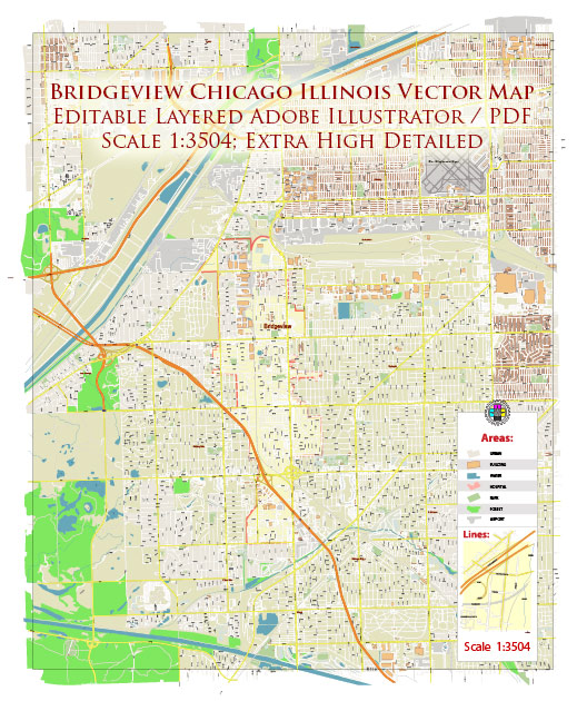
Some general information about Bridgeview, Illinois, details about the economic and transportation.
Vectormap.Net provide you with the most accurate and up-to-date vector maps in Adobe Illustrator, PDF and other formats, designed for editing and printing. Please read the vector map descriptions carefully.
Bridgeview is a village located in Cook County, Illinois, United States. Here’s a brief overview of its economic and transportation aspects:
Economic Overview:
- Diverse Economy: Like many suburban areas, Bridgeview likely has a diverse local economy, with businesses ranging from retail and services to manufacturing and healthcare.
- Employment Opportunities: The village’s economic health is often tied to the broader regional economy. Employment opportunities may be influenced by the presence of local businesses, industrial parks, and commercial establishments.
- Local Businesses: Bridgeview may have a mix of small, medium, and large businesses contributing to its economic landscape. The types of businesses can vary and may include retail stores, restaurants, professional services, and more.
Transportation Overview:
- Road Networks: Bridgeview is likely accessible through a network of roads and highways. The specific road infrastructure in and around the village plays a crucial role in connecting it to nearby towns and cities.
- Public Transportation: The Chicago metropolitan area, including suburbs like Bridgeview, is generally well-connected by public transportation. The Regional Transportation Authority (RTA) provides train (Metra) and bus services. Bridgeview might have local bus routes and, depending on its proximity to Metra stations, residents could use commuter rail services for travel to and from Chicago.
- Airports: O’Hare International Airport and Midway International Airport are the major airports serving the Chicago area. Depending on the location of Bridgeview, residents may have convenient access to one or both of these airports for air travel.
- Rail and Freight: Chicago is a major hub for freight transportation due to its central location in the United States. The village may have connections to rail lines, facilitating the transport of goods and materials.
- Infrastructure Projects: Over the years, there may have been infrastructure projects aimed at improving transportation in and around Bridgeview. These could include road expansions, public transportation enhancements, or other initiatives to improve connectivity.
For the most current and detailed information about the economic and transportation situation in Bridgeview, I recommend checking with local government offices, economic development agencies, and community resources. Additionally, local news sources and Chamber of Commerce websites can provide valuable insights into the latest developments in the area.


 Author: Kirill Shrayber, Ph.D.