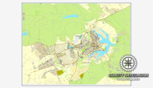
Brasília, the capital city of Brazil, is known for its unique urban planning and modernist architecture. The city was officially inaugurated on April 21, 1960, and its road system is an integral part of the overall design conceived by urban planner Lúcio Costa and architect Oscar Niemeyer.
Vectormap.Net provide you with the most accurate and up-to-date vector maps in Adobe Illustrator, PDF and other formats, designed for editing and printing. Please read the vector map descriptions carefully.
Here is a brief overview of the history of the road system in Brasília:
- Planning and Design (1956-1960):
- The decision to build a new capital in the central part of Brazil was made in the late 1950s to promote the development of the interior and reduce the concentration of political power in the coastal cities.
- Urban planner Lúcio Costa won the design competition, and the city’s layout was inspired by the shape of an airplane or a bird in flight. The city was divided into sectors, and each sector had a specific function, such as residential, commercial, or cultural.
- Road System Design:
- The road system in Brasília is based on a grid pattern with two main axes – the Monumental Axis (Eixo Monumental) and the Residential Axis (Eixo Residencial).
- The Monumental Axis, running from the north to the south, is the city’s central avenue and houses important government buildings, monuments, and cultural institutions.
- The Residential Axis consists of numbered superblocks and is where most of the city’s population resides.
- Monumental Axis:
- The Monumental Axis is flanked by impressive government buildings, including the National Congress, the Presidential Palace, and the Supreme Federal Court.
- It also features the city’s iconic landmarks such as the Cathedral of Brasília, the Three Powers Plaza, and the TV Tower.
- Residential Axis:
- The Residential Axis is divided into numbered superblocks and lettered blocks. Each superblock typically contains residential buildings, schools, and small commercial establishments.
- The idea behind the superblocks is to create a sense of community and shared amenities within each block.
- Integration of Transportation:
- Brasília was designed with a focus on vehicular transportation, and the road system is crucial for the city’s functioning.
- The city’s transportation network includes wide avenues, overpasses, and underpasses, designed to accommodate the planned growth and movement of the city’s residents and visitors.
- Evolution and Challenges:
- Over the years, as the city has grown, there have been challenges in managing traffic congestion and improving public transportation.
- Efforts have been made to enhance the public transportation system, including the introduction of a bus rapid transit (BRT) system, to address the increasing demand for efficient and sustainable transportation.
In summary, the road system in Brasília is a fundamental element of its unique urban design, reflecting the vision of planners and architects in creating a modern, planned city that serves as the political and administrative heart of Brazil.


 Author: Kirill Shrayber, Ph.D. FRGS