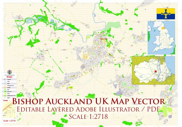
Bishop Auckland is a historic market town in County Durham, England. The development of its road system is intertwined with the town’s history and growth over the centuries. While it may not have a singular, comprehensive history solely dedicated to its road system, we can explore the broader historical context and key developments related to transportation in the region.
Vectormap.Net provide you with the most accurate and up-to-date vector maps in Adobe Illustrator, PDF and other formats, designed for editing and printing. Please read the vector map descriptions carefully.
- Early Roads and Roman Influence (Pre-Medieval Period): The earliest roads in the Bishop Auckland area likely date back to Roman times. The Romans were known for their well-engineered road systems, and the region, being part of Roman Britannia, would have had its share of Roman roads. However, specific details about these ancient roads in the Bishop Auckland area may not be readily available.
- Medieval Period: During the medieval period, Bishop Auckland developed around the Bishop’s castle, which was established in the 12th century. The town would have had rudimentary roads connecting the castle to surrounding villages and market centers. These medieval roads would have been basic and primarily designed for local travel and trade.
- 17th to 19th Century: The growth of Bishop Auckland continued through the centuries, and by the 17th century, the town became an important coal mining and trading center. The demand for better transportation infrastructure increased, leading to the improvement and expansion of roads. Turnpike trusts, private companies that maintained and improved roads in exchange for tolls, became prevalent during the 18th century and played a role in enhancing the road network around Bishop Auckland.
- Industrial Revolution and Railways: The Industrial Revolution brought significant changes to transportation. While railways played a crucial role, road systems continued to be vital for local transportation and trade. The connection of Bishop Auckland to the national rail network in the 19th century further influenced the town’s development.
- 20th Century and Automobiles: The 20th century witnessed the rise of automobiles, transforming transportation once again. Roads in and around Bishop Auckland adapted to accommodate motor vehicles. The expansion of the road network became a priority, linking Bishop Auckland to nearby towns and cities.
- Post-WWII Reconstruction and Modernization: After World War II, reconstruction efforts and modernization initiatives impacted Bishop Auckland’s infrastructure, including roads. The town’s road system evolved to meet the demands of a growing population and changing economic activities.
- Contemporary Era: In recent decades, the road system in and around Bishop Auckland has seen further developments, with considerations for traffic management, safety, and accessibility. Modern infrastructure projects, maintenance efforts, and urban planning contribute to the ongoing evolution of the road network.
In summary, Bishop Auckland’s road system has evolved over the centuries, reflecting the town’s historical significance and responding to the changing needs of its residents and businesses. Studying the broader historical context of transportation in the region provides insights into the development of the road system in Bishop Auckland.


 Author: Kirill Shrayber, Ph.D.