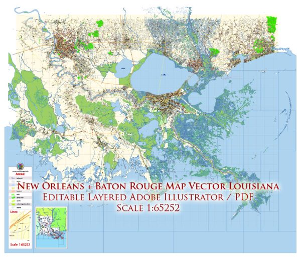
A general overview of the transportation infrastructure in the Baton Rouge and New Orleans areas of Louisiana, USA.
Vectormap.Net provide you with the most accurate and up-to-date vector maps in Adobe Illustrator, PDF and other formats, designed for editing and printing. Please read the vector map descriptions carefully.
1. Roadways:
- Interstate Highways: Both Baton Rouge and New Orleans are well-connected by major interstate highways. Interstate 10 (I-10) is a crucial east-west route that connects the two cities and runs through Baton Rouge.
- Other Highways: Several other highways, including I-12 and I-55, serve the region and facilitate intra-city and inter-city transportation.
2. Bridges:
- Mississippi River Bridges: Baton Rouge and New Orleans are situated along the Mississippi River, and there are several key bridges connecting the east and west banks. Notable bridges include the Huey P. Long Bridge in New Orleans and the Horace Wilkinson Bridge (I-10) in Baton Rouge.
- Other River Crossings: Various other bridges span other water bodies in the region, enhancing connectivity.
3. Public Transportation:
- Bus Services: Both cities have public bus services providing transportation within the urban areas. In New Orleans, the Regional Transit Authority (RTA) operates buses and streetcars.
- Commuter Rail: New Orleans has a commuter rail system known as the New Orleans Regional Transit Authority (NORTA) providing service within the city.
4. Airports:
- Louis Armstrong New Orleans International Airport (MSY): Located in Kenner, near New Orleans, MSY is the primary airport serving the region. It handles domestic and international flights, connecting the area to major cities worldwide.
- Baton Rouge Metropolitan Airport (BTR): This airport serves Baton Rouge, providing domestic flights and contributing to regional air connectivity.
5. Ports and Waterways:
- The Port of New Orleans: One of the largest and busiest ports in the United States, it facilitates the transportation of goods through the Mississippi River and the Gulf of Mexico.
- Baton Rouge Port: Located along the Mississippi River, it is a major inland port handling a variety of cargo.
6. Railroads:
- Rail networks play a crucial role in transporting goods in and out of the region. Multiple rail companies operate in the area, supporting industrial and commercial activities.
7. Cycling and Pedestrian Infrastructure:
- Both cities have been making efforts to improve cycling and pedestrian infrastructure, including bike lanes and walking paths, to promote alternative and sustainable transportation.
It’s important to note that infrastructure projects and developments are subject to change, and it’s advisable to check for the latest information for the most up-to-date details on the transportation infrastructure in Baton Rouge and New Orleans.


 Author: Kirill Shrayber, Ph.D. FRGS