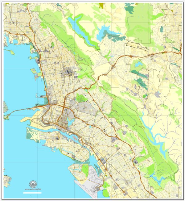
A general overview of the economic and industrial landscape of Alameda, Oakland, and Berkeley in California. Vectormap.Net provide you with the most accurate and up-to-date vector maps in Adobe Illustrator, PDF and other formats, designed for editing and printing. Please read the vector map descriptions carefully.
Alameda:
Economy:
Alameda is a city located in Alameda County, California, and is known for its residential neighborhoods and proximity to the city of Oakland. The economy of Alameda is diverse, with a mix of residential, commercial, and industrial sectors.
Industrial Base:
Alameda has a significant maritime and aerospace industrial presence. The former Naval Air Station Alameda (closed in 1997) played a crucial role in the city’s industrial history. The site has since been redeveloped, and portions of it have been repurposed for various commercial and residential uses.
Oakland:
Economy:
Oakland is a major port city and the largest city in Alameda County. It is a regional economic hub with a diverse economy, including trade, healthcare, technology, and manufacturing.
Port of Oakland:
The Port of Oakland is one of the busiest container ports in the United States. It serves as a gateway for international trade and contributes significantly to the region’s economic activity.
Technology and Healthcare:
Oakland has a growing technology sector, with several startups and tech companies choosing to establish a presence in the city. Additionally, healthcare is a major industry in Oakland, with various medical facilities and research institutions.
Culture and Tourism:
The cultural scene in Oakland is vibrant, with numerous art galleries, theaters, and cultural events. Tourism also plays a role, with attractions such as Jack London Square, Lake Merritt, and the Oakland Museum of California.
Berkeley:
Economy:
Berkeley is known for its cultural and academic institutions and has a diverse economy with a focus on education, research, and local businesses.
Education and Research:
The presence of the University of California, Berkeley, is a major economic driver. The university contributes to the city’s research and development activities and supports a thriving academic community.
Local Businesses:
Berkeley has a strong emphasis on supporting local businesses, with a variety of shops, restaurants, and small enterprises contributing to the city’s economic vitality.
Green and Sustainable Practices:
Berkeley is often at the forefront of green and sustainable initiatives. The city has implemented various policies and programs to promote environmental sustainability and reduce carbon emissions.
Shared Characteristics:
All three cities are part of the broader San Francisco Bay Area, which is a global center for technology and innovation. The region as a whole has a high cost of living, driven in part by the tech industry, and faces challenges related to housing affordability and income inequality.
For the most up-to-date and detailed information, it is recommended to consult recent economic reports, local government sources, and chamber of commerce data specific to each city.


 Author: Kirill Shrayber, Ph.D. FRGS