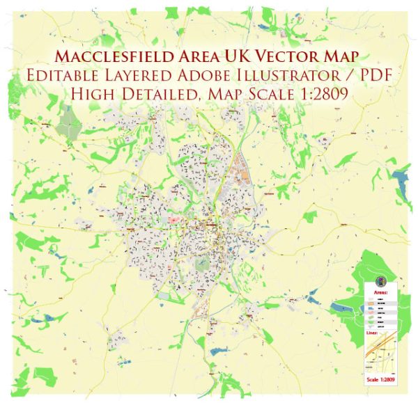
Macclesfield is a market town in Cheshire, and while it doesn’t have traditional “city districts” in the way larger cities might, it does have various neighborhoods and areas that contribute to its overall character.
Vectormap.Net provide you with the most accurate and up-to-date vector maps in Adobe Illustrator, PDF and other formats, designed for editing and printing. Please read the vector map descriptions carefully.
Here are some notable neighborhoods and areas within Macclesfield:
- Town Center:
- The heart of Macclesfield, the town center is characterized by a mix of historical buildings and modern amenities.
- Market Place is a central square surrounded by shops, cafes, and the town hall.
- Commercial Street and Chestergate are main thoroughfares with a range of retail and dining options.
- West Bond Street:
- This area is known for its shopping district, with various shops and boutiques offering a range of products.
- West Bond Street connects the town center to the train station.
- Sutton:
- Located to the southwest of the town center, Sutton is a residential area with a mix of housing types.
- Sutton Hall, a historic building, adds character to the neighborhood.
- Tytherington:
- Situated to the north of the town center, Tytherington is a residential area with schools and parks.
- The Tytherington Club provides leisure and fitness facilities.
- Bollington:
- Although technically a separate town, Bollington is often considered part of the Macclesfield urban area.
- It has a distinct character with a canal, mills, and access to the Peak District.
- Hurdsfield:
- Located to the east of the town center, Hurdsfield is a predominantly residential area.
- It has schools, parks, and community facilities.
- Broken Cross:
- A residential area to the south of the town center, Broken Cross has a mix of housing, schools, and local amenities.
- Rainow:
- Another nearby village, Rainow, is part of the broader Macclesfield area.
- It offers a more rural setting with access to scenic countryside.
- Prestbury:
- Situated to the northeast of Macclesfield, Prestbury is an affluent village with historic architecture.
- It has a golf club and is known for its picturesque surroundings.
- Langley:
- A residential area with schools and parks, Langley is located to the southeast of the town center.
These descriptions provide a general overview, and each neighborhood within Macclesfield has its own unique characteristics. The town and its surrounding villages offer a mix of urban and rural living, catering to a diverse range of residents and visitors.


 Author: Kirill Shrayber, Ph.D.