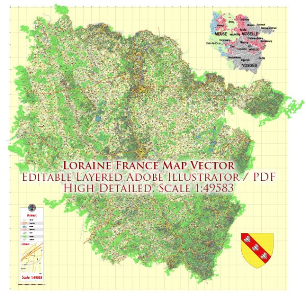
The infrastructure in Lorraine, France, includes a mix of transportation, communication, and public services. Vectormap.Net provide you with the most accurate and up-to-date vector maps in Adobe Illustrator, PDF and other formats, designed for editing and printing. Please read the vector map descriptions carefully. Here’s an overview of the infrastructure in Lorraine:
- Transportation:
- Roads and Highways: Lorraine has an extensive road network, with well-maintained highways and roads connecting major cities and towns. The A31 highway, in particular, is a crucial north-south route passing through the region.
- Public Transport: Cities like Metz and Nancy have developed public transportation systems, including buses and tram services, providing efficient intra-city travel. Additionally, the high-speed TGV trains connect Lorraine to other major French cities and neighboring countries.
- Airports:
- Metz-Nancy-Lorraine Airport: Located between Metz and Nancy, this airport serves the region with domestic and international flights. It contributes to both passenger and cargo transportation.
- Rail Network:
- TGV (Train à Grande Vitesse): Lorraine benefits from the TGV network, with high-speed train services connecting cities like Metz and Nancy to Paris and other French cities. This enhances both regional and national connectivity.
- Ports and Waterways:
- Moselle River: The Moselle River flows through Lorraine, providing a navigable waterway. While not as prominent for cargo transport as other regions, it still plays a role in the transportation network.
- Utilities:
- Energy Infrastructure: Lorraine has a well-developed energy infrastructure, including power plants and electricity distribution networks. The region has been transitioning towards renewable energy sources.
- Water and Sewage: Cities and towns in Lorraine have modern water supply and sewage systems, ensuring access to clean water and proper sanitation.
- Communication:
- Telecommunications: Lorraine is well-connected in terms of telecommunications, with access to high-speed internet and mobile networks. This infrastructure supports both residential and business needs.
- Education and Research Facilities:
- Universities and Research Centers: Lorraine hosts several universities and research institutions with modern facilities. These institutions contribute to the region’s intellectual and scientific infrastructure.
- Healthcare:
- Hospitals and Medical Facilities: Lorraine has a network of hospitals and medical facilities, providing healthcare services to the population.
- Industrial Infrastructure:
- Industrial Zones: Lorraine has industrial zones supporting various sectors, including technology, research, and manufacturing. The historical focus on steel production has evolved, and the region is diversifying its industrial base.
- Tourism Infrastructure:
- Accommodation and Tourism Facilities: Given its historical and cultural significance, Lorraine has a well-developed tourism infrastructure, including hotels, restaurants, and tourist attractions.
It’s important to note that infrastructure is subject to ongoing development and maintenance, and projects may have been initiated or completed since my last update. For the most current information, you should refer to local government sources and official reports.


 Author: Kirill Shrayber, Ph.D.