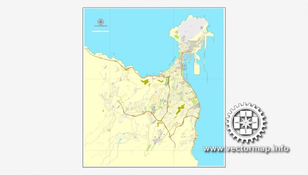
Las Palmas de Gran Canaria is divided into several districts and neighborhoods, each with its own unique character and charm. Vectormap.Net provide you with the most accurate and up-to-date vector maps in Adobe Illustrator, PDF and other formats, designed for editing and printing. Please read the vector map descriptions carefully. Here is a general overview of some key districts and neighborhoods in Las Palmas:
- Vegueta:
- Vegueta is the historic district of Las Palmas and the original settlement of the city. It is characterized by narrow cobblestone streets, colonial-style architecture, and historical landmarks such as the Santa Ana Cathedral and Casa de Colón. Vegueta offers a mix of cultural attractions, museums, and traditional Canarian restaurants.
- Triana:
- Triana is a lively district known for its shopping streets, bustling markets, and vibrant atmosphere. It features a mix of historical and modern architecture, and you’ll find a variety of shops, boutiques, cafes, and restaurants. Triana is also a cultural hub with theaters and art galleries.
- Alcaravaneras:
- This area is close to the beach of Alcaravaneras and the marina. It’s a residential and commercial district with a more relaxed atmosphere. The Playa de Alcaravaneras is a popular spot for water sports and has a promenade with restaurants and cafes.
- Las Canteras:
- Las Canteras is home to one of the most famous urban beaches in Spain, Playa de Las Canteras. The beach is a focal point for residents and tourists alike, offering a long promenade, water sports, and a diverse range of restaurants and bars. The surrounding neighborhood has a youthful and cosmopolitan vibe.
- Santa Catalina:
- Santa Catalina is known for its central park, Parque de Santa Catalina, which hosts various events and festivals. The district is also home to the Alfredo Kraus Auditorium, a modern architectural landmark. The area around Santa Catalina is lively, with shopping streets, entertainment venues, and a mix of restaurants.
- Ciudad Jardín:
- Ciudad Jardín is a residential area known for its well-maintained gardens and parks. It offers a quieter environment compared to some of the more bustling districts. The neighborhood has a mix of residential properties and green spaces.
- La Isleta:
- La Isleta is a peninsula located to the north of Las Palmas. It has a mix of residential areas and natural spaces. The area is known for its picturesque views of the sea and the city. La Isleta also has a fishing port and a maritime atmosphere.
These descriptions provide a general overview, and each district and neighborhood in Las Palmas has its own unique characteristics and appeal. The city offers a diverse range of living environments, from historic districts with cultural significance to modern, vibrant areas with beaches and entertainment options. It’s advisable to explore each area to get a feel for the distinct atmosphere and lifestyle they offer.


 Author: Kirill Shrayber, Ph.D. FRGS