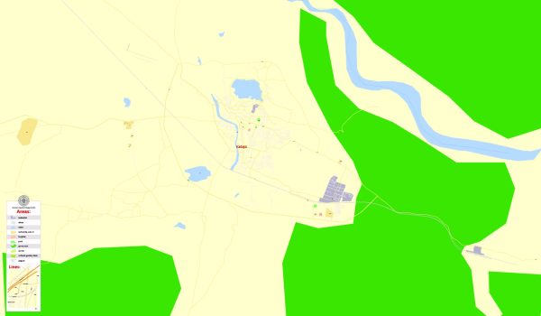
A general overview of the infrastructure in Kadapa, India. Vectormap.Net provide you with the most accurate and up-to-date vector maps in Adobe Illustrator, PDF and other formats, designed for editing and printing. Please read the vector map descriptions carefully. Here’s an overview of the infrastructure in Kadapa:
1. Transportation:
- Roads: Kadapa is well-connected by road. The National Highway 40 passes through the city, linking it to major towns and cities in Andhra Pradesh and neighboring states.
- Railways: The Kadapa Railway Station is an important junction on the South Central Railway network, facilitating both passenger and freight services.
2. Air Connectivity:
- The nearest major airport is Tirupati Airport, which is approximately 180 kilometers away from Kadapa. Renigunta, the closest railway station to Tirupati Airport, is also an alternative transportation option for air travelers.
3. Public Transport:
- Kadapa has a network of buses that provide intra-city and inter-city transportation services. Additionally, auto-rickshaws and cycle rickshaws contribute to local transportation within the city.
4. Water Supply:
- The city receives water supply from various sources, including local reservoirs, groundwater, and potentially the Kundu River. Local municipal authorities are responsible for managing and maintaining the water supply infrastructure.
5. Power Supply:
- Electricity in Kadapa is supplied by the Andhra Pradesh Southern Power Distribution Company Limited (APSPDCL). The power infrastructure includes substations, transmission lines, and distribution networks.
6. Educational Infrastructure:
- Kadapa has educational institutions ranging from schools to colleges and technical institutions. These institutions contribute to the city’s educational infrastructure, catering to the academic needs of the local population.
7. Healthcare Facilities:
- The city has hospitals, clinics, and healthcare centers to address the medical needs of the residents. Some of these facilities are operated by the government, while others are privately owned.
8. Commercial and Industrial Infrastructure:
- Kadapa’s economy is supported by industries such as cement production, agriculture-related activities, and trade. The industrial infrastructure includes factories, warehouses, and related facilities.
9. Civic Amenities:
- Kadapa has civic amenities such as parks, public spaces, and community centers. Local municipal authorities are responsible for maintaining these facilities for the well-being and recreation of the residents.
10. Telecommunications:
- Telecommunication services, including landline and mobile networks, are available in Kadapa. Internet connectivity is provided by various service providers.
It’s important to note that infrastructure development is an ongoing process, and governments at various levels continue to invest in improving and expanding the infrastructure in cities like Kadapa. For the most up-to-date information, you may want to check with local authorities or refer to recent reports and news articles.


 Author: Kirill Shrayber, Ph.D. FRGS