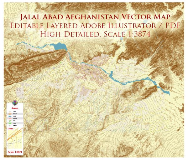
Jalalabad, Afghanistan, a general overview based on historical and geographical context. Vectormap.Net provide you with the most accurate and up-to-date vector maps in Adobe Illustrator, PDF and other formats, designed for editing and printing. Please read the vector map descriptions carefully.
Jalalabad is a city in eastern Afghanistan, serving as the capital of Nangarhar Province. Here are some general characteristics of the city:
- Geography:
- Jalalabad is situated in the eastern part of Afghanistan, near the border with Pakistan.
- The city is located in the fertile Jalalabad plain, which is irrigated by the Kabul River.
- Historical Significance:
- The region around Jalalabad has a rich history, with influences from various civilizations and cultures due to its strategic location on the ancient trade routes.
- It has been a center for trade and commerce for centuries and has witnessed the passage of various conquerors and empires.
- Economy:
- Traditionally, agriculture has played a significant role in the economy of Jalalabad, thanks to the fertile plains and the availability of water from the Kabul River.
- The city has also been a center for trade and commerce due to its location on important trade routes.
- Cultural and Ethnical Diversity:
- Like much of Afghanistan, Jalalabad is characterized by a diverse ethnic and cultural mix. Pashtuns are the dominant ethnic group in the region.
- The city has historically been home to various communities, and this diversity is reflected in its cultural heritage.
- Security Situation:
- Afghanistan, including Jalalabad, has faced security challenges due to ongoing conflicts and geopolitical issues. The security situation can vary, and it’s advisable to stay updated on the current conditions.
- Infrastructure:
- The city has both modern and traditional infrastructure, with markets, mosques, and other facilities.
- Transportation routes connect Jalalabad to other major cities in Afghanistan and neighboring countries.
Please note that the situation in Afghanistan can change rapidly, especially considering the geopolitical and security context. For the most accurate and up-to-date information, it’s recommended to consult recent sources, news outlets, or official government statements.


 Author: Kirill Shrayber, Ph.D. FRGS