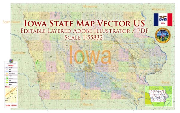
Iowa is a landlocked state in the Midwestern United States, and it is characterized by a diverse geography that includes rivers, lakes, and other water bodies. Here are some notable rivers and lakes in Iowa:
Rivers:
- Mississippi River: The eastern border of Iowa is formed by the mighty Mississippi River, one of the longest rivers in North America. The river not only serves as a natural boundary but also plays a significant role in transportation, recreation, and wildlife habitat.
- Missouri River: The western border of Iowa is marked by the Missouri River. This river is another major waterway in the United States and has historical significance in the westward expansion of the country.
- Des Moines River: The Des Moines River flows across the state, from northwest to southeast, and passes through the capital city, Des Moines. It is a tributary of the Mississippi River and is important for both agriculture and recreation.
- Cedar River: This river flows through northern Iowa, passing through cities like Cedar Rapids. The Cedar River is known for its scenic beauty and is a popular destination for boating and fishing.
- Iowa River: Flowing through central Iowa, the Iowa River is a tributary of the Mississippi River. It passes through cities such as Iowa City and Coralville, providing recreational opportunities and supporting local ecosystems.
Lakes:
- Spirit Lake: Located in the northwestern part of the state, Spirit Lake is one of Iowa’s largest natural lakes. It is a popular destination for boating, fishing, and other water-based activities.
- West Okoboji Lake: Situated in the Iowa Great Lakes region, West Okoboji Lake is known for its clear blue waters and is a popular spot for boating, fishing, and water sports.
- Clear Lake: Located in north-central Iowa, Clear Lake is a popular recreational destination known for its clear waters. It offers opportunities for boating, fishing, and camping.
- Saylorville Lake: This reservoir on the Des Moines River is located just north of Des Moines. It was created by the Saylorville Dam and provides flood control, recreation, and water supply for the region.
- Red Rock Reservoir: Formed by the Red Rock Dam on the Des Moines River, this reservoir is one of the largest in Iowa. It offers a variety of recreational activities, including boating, fishing, and camping.
These water bodies contribute to Iowa’s natural beauty and provide opportunities for outdoor recreation and tourism. Additionally, they play essential roles in supporting ecosystems, providing water resources, and contributing to the state’s agricultural activities.
Vectormap.Net provide you with the most accurate and up-to-date vector maps in Adobe Illustrator, PDF and other formats, designed for editing and printing. Please read the vector map descriptions carefully.


 Author: Kirill Shrayber, Ph.D. FRGS