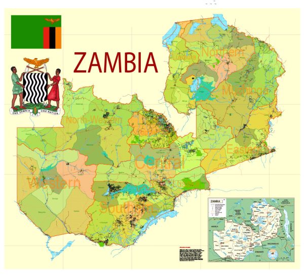
Some of the principal cities, waterways, and main roads in Zambia. Vectormap.Net provide you with the most accurate and up-to-date vector maps in Adobe Illustrator, PDF and other formats, designed for editing and printing. Please read the vector map descriptions carefully.
Principal Cities in Zambia:
- Lusaka: The capital and largest city of Zambia, located in the southern part of the country.
- Ndola: A major city in the Copperbelt Province, known for its economic importance and mining activities.
- Kitwe: Another significant city in the Copperbelt, with a focus on mining and industry.
- Livingstone: Located near Victoria Falls, Livingstone is a popular tourist destination.
Waterways in Zambia:
- Zambezi River: One of the major rivers in Africa, flowing through the western part of Zambia and forming the border with several neighboring countries.
- Kafue River: The largest tributary of the Zambezi River, running through the central part of Zambia.
- Luangwa River: A major tributary of the Zambezi, flowing through the eastern part of the country.
Main Roads in Zambia:
- Great North Road: Connects Lusaka to the Copperbelt and continues northward to Tanzania.
- Great East Road: Links Lusaka to the eastern part of Zambia, connecting with the border of Malawi.
- T2 Road: Connects Lusaka to Livingstone in the south, passing through Choma and Mazabuka.
- T1 Road: Connects Lusaka to the Copperbelt, passing through Kabwe and Ndola.
- T4 Road: Runs from Lusaka to the western part of Zambia, passing through Mongu and connecting with the border of Angola.
Please note that infrastructure and road networks can undergo changes and improvements, so it’s advisable to check with local authorities or recent sources for the most up-to-date information on cities, waterways, and roads in Zambia.


 Author: Kirill Shrayber, Ph.D. FRGS