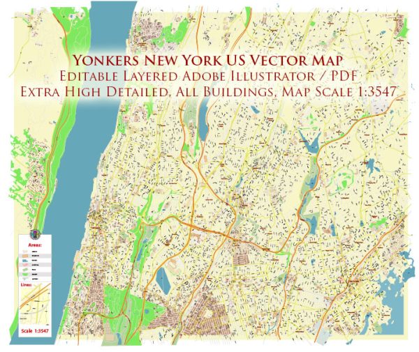
Some general information about Yonkers, New York, including its principal waterways, bridges, and main streets and roads. Vectormap.Net provide you with the most accurate and up-to-date vector maps in Adobe Illustrator, PDF and other formats, designed for editing and printing. Please read the vector map descriptions carefully.
Waterways: Yonkers is situated along the Hudson River, which is one of the principal waterways in the region. The river plays a significant role in the city’s geography and history.
Bridges: Several bridges connect Yonkers to other parts of the region. One notable bridge is the Yonkers Public Library, which spans the Metro-North Railroad tracks, connecting the library to the waterfront. Additionally, the city is in proximity to several other bridges that cross the Hudson River, connecting Westchester County to New York City.
Main Streets and Roads:
- Central Park Avenue (Route 100): This is a major north-south thoroughfare that runs through Yonkers, connecting the city to other parts of Westchester County.
- Yonkers Avenue: Another important north-south road, Yonkers Avenue runs parallel to Central Park Avenue and provides access to various neighborhoods within the city.
- McLean Avenue: Running east-west, McLean Avenue is a key street in Yonkers, known for its commercial and residential areas.
- Cross County Parkway: This is a significant east-west parkway that connects Yonkers to other parts of Westchester County.
- Saw Mill River Parkway: This parkway runs along the eastern border of Yonkers and is an important transportation route in the region.
Please note that Yonkers has an extensive network of streets and roads, and the ones mentioned above are just a few examples of the major routes. For the most up-to-date and detailed information, it’s recommended to check with local authorities or use online mapping services.


 Author: Kirill Shrayber, Ph.D. FRGS