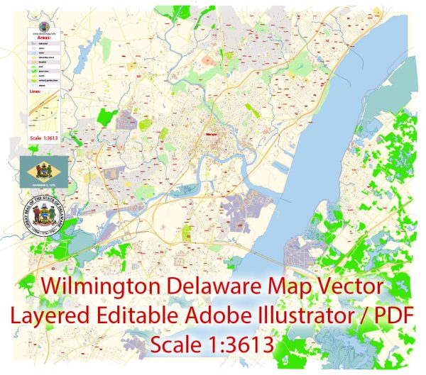
Wilmington, Delaware, is a city with several principal waterways, bridges, and main streets. Vectormap.Net provide you with the most accurate and up-to-date vector maps in Adobe Illustrator, PDF and other formats, designed for editing and printing. Please read the vector map descriptions carefully.
Principal Waterways:
- Christina River: This river flows through Wilmington, playing a significant role in the city’s history and development. The Christina Riverwalk, a scenic pathway along the river, is a popular area for recreation and events.
- Brandywine Creek: Another important waterway, the Brandywine Creek, flows through the northern part of Wilmington. It has historical significance and is associated with the Brandywine Valley, known for its picturesque landscapes.
Bridges:
- Wilmington & Western Railroad Bridge: This historic bridge is located over the Brandywine Creek and is associated with the Wilmington & Western Railroad, a heritage railway.
- St. Georges Bridge: Located a bit south of Wilmington, this bridge spans the Chesapeake & Delaware Canal, connecting New Castle County with the southern parts of Delaware.
- Delaware Memorial Bridge: While not directly in Wilmington, this twin-span suspension bridge connects Delaware and New Jersey, serving as a major transportation link for the region. It’s located a short drive northeast of Wilmington.
Main Streets:
- Market Street: Market Street is one of the main thoroughfares in downtown Wilmington. It is home to various businesses, shops, restaurants, and cultural institutions.
- King Street: Another prominent street in Wilmington, King Street runs through the heart of the city, featuring a mix of commercial, residential, and historic buildings.
- Delaware Avenue: This avenue is known for its historic homes and serves as a connection between Trolley Square and downtown Wilmington.
- Lancaster Avenue: Running westward from downtown, Lancaster Avenue is an important street that connects various neighborhoods and commercial areas.


 Author: Kirill Shrayber, Ph.D. FRGS