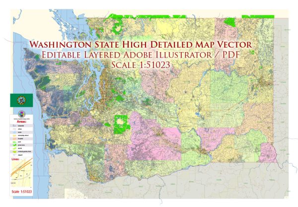
Washington State, located in the Pacific Northwest region of the United States, is known for its diverse geography, vibrant cities, and natural beauty. Here’s a description of some of the principal cities, prominent waterways, and main roads in the state:
Principal Cities:
- Seattle: The largest city in Washington and a major economic and cultural hub. Known for its iconic Space Needle, vibrant neighborhoods like Capitol Hill, and as the headquarters of companies like Amazon and Microsoft.
- Tacoma: Located south of Seattle, Tacoma is known for its industrial port, the Museum of Glass, and the stunning Mount Rainier views.
- Spokane: Situated in the eastern part of the state, Spokane is known for its riverfront park, vibrant arts scene, and outdoor recreational opportunities.
- Bellevue: A suburb of Seattle, Bellevue is a rapidly growing city with a thriving tech industry and upscale shopping areas like Bellevue Square.
- Vancouver: Not to be confused with the Canadian city of the same name, Vancouver is located in the southwestern part of Washington and is known for its historic downtown and proximity to the Columbia River Gorge.
Waterways:
- Puget Sound: A complex estuarine system of interconnected marine waterways and basins, Puget Sound is a defining feature of the region, providing habitat for diverse marine life and offering scenic views.
- Columbia River: One of the largest rivers in North America, the Columbia River flows through the state, marking the border with Oregon. It’s a significant waterway for transportation, irrigation, and hydroelectric power generation.
- Lake Washington: Located between Seattle and Bellevue, Lake Washington is the second-largest natural lake in the state and is popular for boating and recreational activities.
- Pacific Ocean: Washington has a rugged coastline along the Pacific Ocean, featuring beaches, cliffs, and opportunities for marine activities.
Main Roads:
- Interstate 5 (I-5): Running north-south, I-5 is the primary interstate highway in Washington, connecting major cities such as Seattle, Tacoma, and Vancouver.
- Interstate 90 (I-90): An east-west interstate that connects Seattle to Spokane, passing through the Cascade Range.
- State Route 520 (SR-520): A major highway connecting Seattle and Bellevue, crossing Lake Washington via the Evergreen Point Floating Bridge.
- US Route 2 (US-2): An east-west highway that traverses the northern part of the state, providing access to cities like Everett and Spokane.
- US Route 101 (US-101): Encircling the Olympic Peninsula, US-101 offers scenic views and access to coastal towns.
These are just a few highlights, and Washington State’s diverse landscape provides a wide range of experiences for residents and visitors alike.


 Author: Kirill Shrayber, Ph.D.