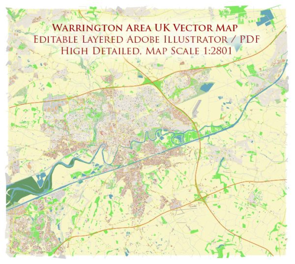
Some general information about the Warrington area in the UK, including its principal waterways, bridges, and main streets. Vectormap.Net provide you with the most accurate and up-to-date vector maps in Adobe Illustrator, PDF and other formats, designed for editing and printing. Please read the vector map descriptions carefully.
Waterways:
- Manchester Ship Canal: Warrington is situated along the Manchester Ship Canal, a major artificial waterway that connects Manchester to the Irish Sea. The canal is important for shipping and transportation of goods.
- River Mersey: The River Mersey flows near Warrington, playing a significant role in the region’s geography. It is one of the major rivers in the northwest of England.
Bridges:
- Warrington Transporter Bridge: An iconic landmark, the Warrington Transporter Bridge spans the River Mersey. It is a historic transporter bridge, allowing vehicles and pedestrians to cross the river.
- Kingsway and Queensway Bridges: These are important road bridges that connect the two halves of Warrington across the River Mersey.
Main Streets:
- Bridge Street: Located in the town center, Bridge Street is a major shopping and commercial area with a variety of shops, restaurants, and businesses.
- Scotland Road: This road runs through the town and is a key route for transportation.
- Winwick Street: Another significant street in Warrington, Winwick Street is known for its shops and services.
- Sankey Street: A central street in Warrington, Sankey Street is home to various shops, cafes, and businesses.
- Wilderspool Causeway: This road runs alongside the River Mersey and is an important route for travel in the area.
Please note that developments may have occurred since my last update, and new infrastructure projects or changes to existing structures may have taken place. For the most accurate and current information, it’s recommended to check with local authorities, maps, or recent online sources specific to Warrington.


 Author: Kirill Shrayber, Ph.D. FRGS