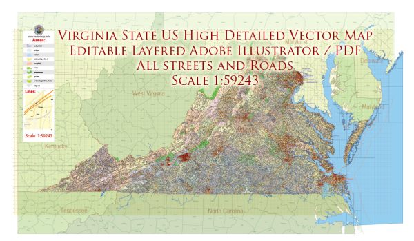
Virginia, a state located in the southeastern part of the United States, is known for its rich history, diverse geography, and vibrant cities. Here’s an overview of some principal cities, significant waterways, and main roads in Virginia:
Principal Cities:
- Richmond: The capital of Virginia, Richmond is known for its historical significance, including being the capital of the Confederacy during the American Civil War. It has a thriving arts scene, historic architecture, and is situated along the James River.
- Virginia Beach: Located on the Atlantic Ocean, Virginia Beach is a popular tourist destination known for its beaches, boardwalk, and various recreational activities. It is the most populous city in Virginia.
- Norfolk: A major port city situated on the Chesapeake Bay, Norfolk is known for its maritime heritage, naval presence (home to the world’s largest naval base), and cultural attractions.
- Arlington: Adjacent to Washington, D.C., Arlington is known for Arlington National Cemetery, the Pentagon, and proximity to the nation’s capital. It has a mix of residential, commercial, and government areas.
- Alexandria: A historic city along the Potomac River, Alexandria has a well-preserved Old Town with cobblestone streets and 18th- and 19th-century architecture. It is part of the Washington, D.C. metropolitan area.
Waterways:
- Chesapeake Bay: The largest estuary in the United States, the Chesapeake Bay is a vital waterway for Virginia. It has a significant impact on the state’s ecology, economy, and recreational activities.
- James River: Flowing through central Virginia, the James River is important historically and environmentally. Richmond, the capital, is situated along its banks.
- Potomac River: The Potomac forms part of Virginia’s northern border with Maryland and Washington, D.C. It is a major tributary of the Chesapeake Bay.
Main Roads:
- Interstate 95 (I-95): One of the primary north-south highways on the East Coast, I-95 runs through Virginia, connecting major cities such as Richmond and Alexandria.
- Interstate 64 (I-64): An east-west interstate, I-64 connects the cities of Richmond and Norfolk, passing through Hampton Roads.
- U.S. Route 1 (US-1): Running parallel to I-95, US-1 is a historic route connecting many cities, including Alexandria and Fredericksburg.
- U.S. Route 460 (US-460): This highway runs east-west across Virginia, connecting cities like Norfolk, Petersburg, and Roanoke.
- Virginia State Route 288 (VA-288): A major highway forming a partial beltway around Richmond, VA-288 facilitates transportation in the greater Richmond area.
These are just a few highlights, and Virginia has a comprehensive network of roads and waterways that contribute to its economic and cultural vitality.
Vectormap.Net provide you with the most accurate and up-to-date vector maps in Adobe Illustrator, PDF and other formats, designed for editing and printing. Please read the vector map descriptions carefully.


 Author: Kirill Shrayber, Ph.D.