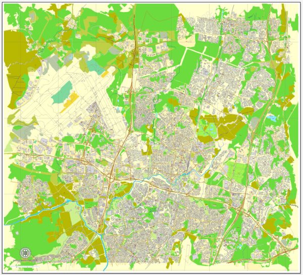
Some general information about Vantaa, Finland’s principal waterways, bridges, and main streets. Vectormap.Net provide you with the most accurate and up-to-date vector maps in Adobe Illustrator, PDF and other formats, designed for editing and printing. Please read the vector map descriptions carefully.
Waterways: Vantaa is situated in southern Finland and is characterized by several waterways. The main river flowing through Vantaa is the Vantaa River, which is a significant watercourse in the region. The river plays a crucial role in the city’s geography and is often surrounded by green spaces.
Bridges: Several bridges cross the Vantaa River and its tributaries, connecting different parts of the city. One notable bridge is the Keravanjoki Bridge, which spans the Keravanjoki River. Additionally, the city features various pedestrian and road bridges that facilitate movement across water bodies.
Main Streets: Vantaa has a well-developed road network with several main streets and highways connecting different parts of the city. Some of the main streets in Vantaa include:
- Ring Roads (Kehä I, Kehä II): These are major ring roads that encircle the Helsinki metropolitan area, including parts of Vantaa. They play a crucial role in regional transportation.
- Vihdintie (Vihdintie): This road connects Vantaa to neighboring areas and is an important route for commuters.
- Hämeenlinnanväylä (Hämeenlinnanväylä): This is a significant highway passing through Vantaa, connecting it to Helsinki and other parts of southern Finland.
- Kielotie (Kielotie): Kielotie is an example of a local road that serves different neighborhoods within Vantaa.
- Rajatorpantie (Rajatorpantie): Another example of a road connecting various parts of the city.


 Author: Kirill Shrayber, Ph.D. FRGS