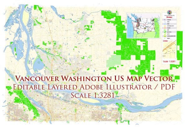
Vancouver, Washington, is located along the northern bank of the Columbia River, which serves as a significant waterway for the region. Here are some key features related to waterways, bridges, and main streets in Vancouver:
Waterways:
- Columbia River: The Columbia River is one of the major waterways in the area, flowing along the northern border of Vancouver. It is the fourth-largest river in the United States and plays a crucial role in transportation, recreation, and commerce.
- Vancouver Lake: Located west of the city, Vancouver Lake is a large freshwater lake that contributes to the recreational activities in the region.
Bridges:
- Interstate Bridge: The Interstate Bridge, officially named the Glenn Jackson Bridge, spans the Columbia River and connects Vancouver to Portland, Oregon. It is a vital transportation link for commuters and travelers between the two states.
- Mill Plain Bridge: This bridge connects the neighborhoods of Vancouver, providing a crucial east-west connection over the river.
- Fourth Plain Bridge: Another important bridge, the Fourth Plain Bridge, serves as a key crossing over the river and facilitates the movement of traffic in the city.
Main Streets:
- Main Street: Vancouver’s Main Street is a central thoroughfare running through the downtown area, lined with shops, restaurants, and businesses. It serves as a focal point for local events and community activities.
- Broadway Street: Broadway Street is another significant thoroughfare that runs parallel to Main Street, offering additional commercial and residential areas.
- Mill Plain Boulevard: Mill Plain Boulevard is an east-west corridor that provides access to various neighborhoods, commercial centers, and recreational facilities.
- Washington Street: Washington Street is an important north-south road in the city, contributing to the overall transportation network.
- East Evergreen Boulevard: This boulevard runs along the northern bank of the Columbia River, providing scenic views and access to parks and recreational areas.
These are just a few examples, and the city has a comprehensive network of streets and roads connecting various neighborhoods, commercial districts, and recreational spots. As the city continues to develop, infrastructure may evolve, so it’s advisable to check for updates from local sources for the latest information.
Vectormap.Net provide you with the most accurate and up-to-date vector maps in Adobe Illustrator, PDF and other formats, designed for editing and printing. Please read the vector map descriptions carefully.


 Author: Kirill Shrayber, Ph.D.