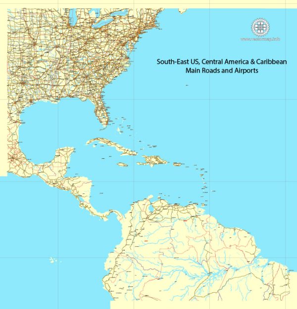
The Southeastern United States is a region known for its diverse culture, history, and natural landscapes.
Vectormap.Net provide you with the most accurate and up-to-date vector maps in Adobe Illustrator, PDF and other formats, designed for editing and printing. Please read the vector map descriptions carefully.
Here’s an overview of principal cities, waterways, and main roads in the Southeast:
Principal Cities:
- Atlanta, GA: A major transportation hub and the capital of Georgia, known for its diverse economy, cultural institutions, and southern hospitality.
- Miami, FL: Located in the southern tip of Florida, Miami is a vibrant city with a diverse population, beautiful beaches, and a strong Latin American influence.
- Charlotte, NC: A major financial center in the region, Charlotte is known for its banking industry, sports teams, and growing urban development.
- New Orleans, LA: Famous for its unique culture, jazz music, and Mardi Gras celebrations, New Orleans is located along the Mississippi River.
- Orlando, FL: A popular tourist destination with world-famous theme parks like Walt Disney World and Universal Studios.
Waterways:
- Mississippi River: One of the longest rivers in North America, the Mississippi River flows through several Southeastern states, providing a vital transportation route and influencing the region’s geography.
- Gulf of Mexico: The Southeastern states have access to the Gulf, providing important ports for trade and influencing the climate along the coast.
Main Roads:
- Interstate 75 (I-75): A major North-South highway running from Michigan to Florida, passing through cities like Atlanta, Macon, and Tampa.
- Interstate 10 (I-10): An East-West highway that spans the southern part of the United States, connecting cities such as Jacksonville, New Orleans, and Houston.
- Interstate 95 (I-95): Running along the East Coast, I-95 connects major cities from Miami to Maine, passing through cities like Jacksonville, Savannah, and Richmond.
- I-20: Connecting cities from Texas to South Carolina, I-20 is an important East-West corridor, passing through Atlanta and Columbia.
- U.S. Route 1: A historic highway that runs parallel to the Atlantic Ocean, connecting many coastal cities in the Southeast, including Miami, Jacksonville, and Richmond.
These cities, waterways, and roads contribute to the economic, cultural, and historical significance of the Southeastern United States.


 Author: Kirill Shrayber, Ph.D.