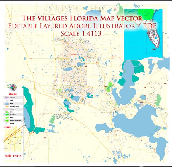
The Villages is a large retirement community in Florida, known for its extensive amenities and recreational opportunities. Vectormap.Net provide you with the most accurate and up-to-date vector maps in Adobe Illustrator, PDF and other formats, designed for editing and printing. Please read the vector map descriptions carefully. Here’s a general description of the principal waterways, bridges, and main streets in The Villages:
Principal Waterways:
- Lake Sumter: This is one of the major lakes in The Villages and is centrally located. It is often surrounded by recreation areas, shopping districts, and entertainment options.
- Lake Miona: Another notable lake in The Villages, offering scenic views and recreational activities.
- Lake Griffin: While not within The Villages itself, Lake Griffin is nearby and part of the Harris Chain of Lakes, providing opportunities for boating and fishing.
Bridges:
- Lake Sumter Landing Bridge: Connecting the northern and southern shores of Lake Sumter, this bridge is a prominent feature, especially around Lake Sumter Landing Market Square.
- Spanish Springs Bridge: This bridge connects the eastern and western sides of The Villages, particularly around the Spanish Springs Town Square.
Main Streets and Town Squares:
- Sumter Landing: This area is known for its waterfront views, restaurants, shops, and a square where events and live entertainment often take place.
- Spanish Springs: Another popular town square with a Spanish-inspired theme, offering dining, shopping, and entertainment options.
- Brownwood Paddock Square: Located in the southern part of The Villages, Brownwood Paddock Square features a Western theme and hosts various events, restaurants, and shops.
Major Streets:
- Buena Vista Boulevard: A significant north-south road running through The Villages, connecting different neighborhoods and commercial areas.
- Morse Boulevard: Found in the central part of The Villages, Morse Boulevard is known for its scenic surroundings and access to various amenities.
- Warm Springs Avenue: This street runs through parts of The Villages and intersects with other major roads, providing access to different neighborhoods.
Please verify this information with more recent sources, as The Villages is a rapidly growing community, and there may have been changes or additions to its infrastructure since my last update.


 Author: Kirill Shrayber, Ph.D. FRGS