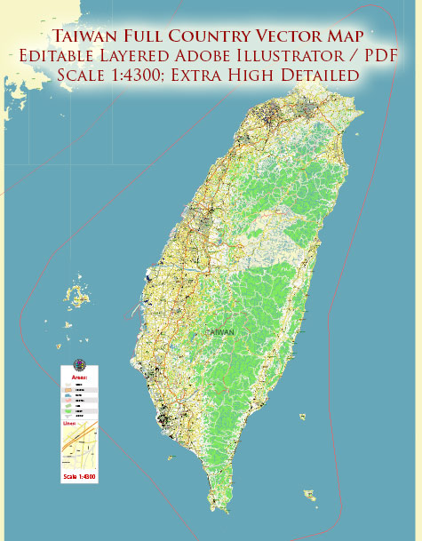
Taiwan is an island nation located in East Asia, officially known as the Republic of China (ROC). It consists of one main island and several smaller islands. The principal cities, waterways, and main roads in Taiwan are essential features of its geography and infrastructure.
Principal Cities:
- Taipei: The capital and largest city of Taiwan, located in the northern part of the island. Taipei is the political, economic, and cultural center of Taiwan.
- Kaohsiung: The second-largest city, situated in the southern part of Taiwan. It is a major port city and an industrial hub with a vibrant cultural scene.
- Taichung: Located in the central part of Taiwan, Taichung is the third-largest city. It serves as an important economic and cultural center, known for its parks, museums, and shopping districts.
- Tainan: Situated in the southern part of the island, Tainan is one of Taiwan’s oldest cities with a rich history. It was the island’s capital during imperial times and is known for its historical temples.
- Taoyuan: Close to Taipei in the northern part of Taiwan, Taoyuan is a key transportation hub and is home to Taiwan’s main international airport, Taoyuan International Airport.
Waterways:
- Taiwan Strait: Separating Taiwan from the southeastern coast of China, the Taiwan Strait is a crucial waterway for shipping and trade.
- East China Sea: To the north of Taiwan, the East China Sea provides access to international waters and is important for maritime activities.
- South China Sea: To the south of Taiwan, the South China Sea is another significant body of water that influences Taiwan’s maritime trade routes.
- Keelung River: Flowing through the northern part of Taiwan, the Keelung River is an essential waterway, and its basin is home to the capital city, Taipei.
- Love River (Ai River): Located in Kaohsiung, the Love River is a picturesque waterway that has been revitalized and is now a popular destination for leisure and entertainment.
Main Roads:
- National Freeway System: Taiwan has a well-developed network of national freeways connecting major cities. The National Freeway 1 (North-South Freeway) and National Freeway 3 (Formosa Freeway) are two of the main arteries.
- Provincial Highways: In addition to national freeways, provincial highways crisscross the island, providing essential road connectivity.
- Taipei Metro: Taipei has a modern and efficient metro system that serves the capital and its surrounding areas.
- Kaohsiung Mass Rapid Transit (KMRT): Kaohsiung’s metro system, also known as the KMRT, facilitates transportation within the city and its suburbs.
- North-Cross Island Highway: This scenic highway crosses the central mountain range, providing breathtaking views of Taiwan’s mountainous terrain.
These features contribute to Taiwan’s connectivity, economic activities, and cultural vibrancy. The island’s geography, with its mountains and coastline, adds to the diversity and uniqueness of its regions.


 Author: Kirill Shrayber, Ph.D.