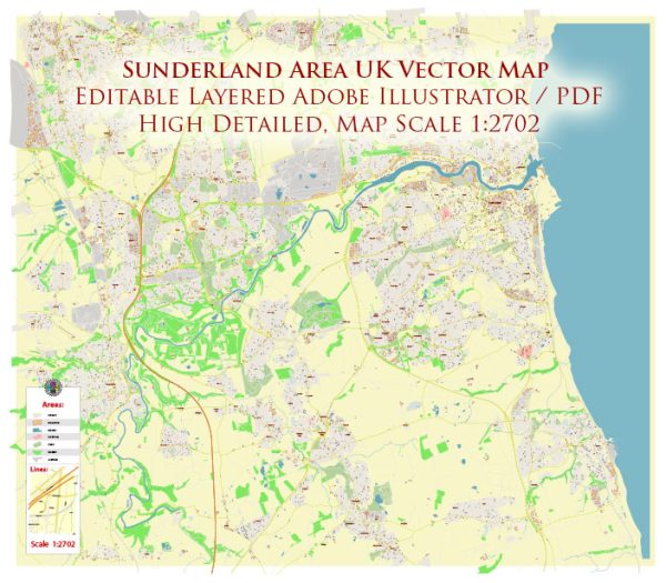
A general overview of the principal waterways, bridges, and main streets in the Sunderland area, UK. Vectormap.Net provide you with the most accurate and up-to-date vector maps in Adobe Illustrator, PDF and other formats, designed for editing and printing. Please read the vector map descriptions carefully.
Principal Waterways:
- River Wear: The River Wear flows through Sunderland, playing a significant role in the city’s history and development. The river has been essential for trade and transportation.
Bridges:
- Wearmouth Bridge: This iconic bridge spans the River Wear and connects the areas of Monkwearmouth and Bishopwearmouth. The current bridge is a modern version, but there have been several bridges on this site throughout history.
- Queen Alexandra Bridge: Another notable bridge crossing the River Wear, connecting Pallion and Southwick. It is a historic bridge with a distinctive design.
Main Streets and Areas:
- High Street West: This is a major street in the city center, featuring shops, restaurants, and entertainment venues.
- Fawcett Street: Another significant street in the city center, known for its shopping options and commercial activities.
- The Bridges Shopping Centre: Located in the heart of Sunderland, this shopping center is a popular destination for retail therapy.
- St. Mary’s Boulevard: This area is close to the University of Sunderland and features academic buildings and student facilities.
- Sunderland Marina: Situated on the north bank of the River Wear, the marina is a recreational area with bars, restaurants, and boat moorings.
Please note that urban landscapes can change, and new developments may have occurred since my last update. For the most current and detailed information, I recommend checking with local authorities, maps, or online resources that provide real-time updates on the Sunderland area.


 Author: Kirill Shrayber, Ph.D. FRGS