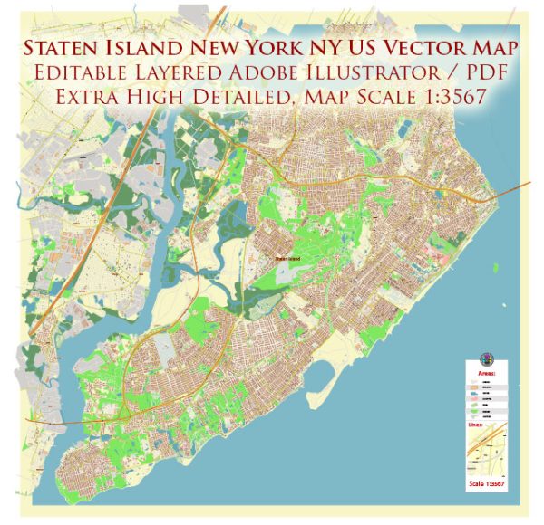
Staten Island, one of the five boroughs of New York City, is surrounded by water and connected to the other boroughs by bridges and tunnels. Here’s an overview of the principal waterways, bridges, and main streets and roads in Staten Island:
Waterways:
- Arthur Kill: This tidal strait separates Staten Island from the mainland of New Jersey. It serves as a natural boundary to the west.
- Kill Van Kull: Another tidal strait, Kill Van Kull, separates Staten Island from Bayonne, New Jersey, to the north. It connects Upper New York Bay with Newark Bay.
- The Narrows: This is the tidal strait that connects Upper New York Bay with Lower New York Bay and separates Staten Island from Brooklyn. It is spanned by the Verrazzano-Narrows Bridge.
Bridges:
- Verrazzano-Narrows Bridge: Connecting Staten Island to Brooklyn, this suspension bridge spans the Narrows. It is a major transportation link and offers stunning views of the New York Harbor.
- Goethals Bridge: Connecting Staten Island with Elizabeth, New Jersey, this bridge spans the Arthur Kill.
- Bayonne Bridge: This steel arch bridge connects Staten Island with Bayonne, New Jersey, spanning the Kill Van Kull.
- Outerbridge Crossing: Connecting Staten Island with Perth Amboy, New Jersey, this bridge spans the Arthur Kill. It is named after Eugenius H. Outerbridge, the first chairman of the Port Authority of New York and New Jersey.
Main Streets and Roads:
- Richmond Avenue: A major north-south artery on the island, running through the center of Staten Island.
- Hylan Boulevard: Another significant north-south road, stretching from the north to the south shore of Staten Island.
- Staten Island Expressway (I-278): This highway connects the Verrazzano-Narrows Bridge to the Goethals Bridge, providing a crucial east-west route across the island.
- West Shore Expressway (NY 440): Running along the western shore of Staten Island, this highway connects the southern and northern parts of the island.
- Martin Luther King Jr. Expressway: Connecting the Staten Island Expressway to the Bayonne Bridge, this expressway is an important east-west route.
These are some of the key waterways, bridges, and main streets and roads in Staten Island, providing essential transportation links within the borough and connecting it to neighboring areas.
Vectormap.Net provide you with the most accurate and up-to-date vector maps in Adobe Illustrator, PDF and other formats, designed for editing and printing. Please read the vector map descriptions carefully.


 Author: Kirill Shrayber, Ph.D. FRGS