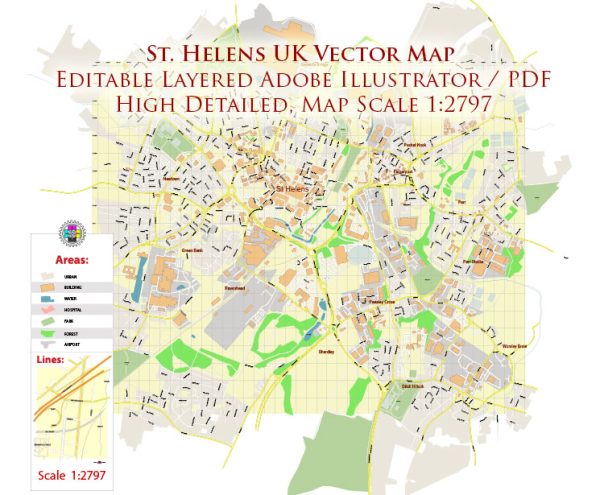
A general overview of St Helens, UK, including its principal waterways, bridges, and main streets. Vectormap.Net provide you with the most accurate and up-to-date vector maps in Adobe Illustrator, PDF and other formats, designed for editing and printing. Please read the vector map descriptions carefully.
Waterways: St Helens is situated in Merseyside, in the northwest of England. The town is not known for major waterways, but there are several smaller rivers and streams in the surrounding area. The Sankey Canal, one of the oldest canals in the world, historically played a significant role in the transportation of coal from the local mines.
Bridges: St Helens has various bridges that span over local watercourses and roads. The specific bridges can vary, and notable ones might include those over the Sankey Canal or other smaller rivers and streams. Some bridges could be historical structures with architectural significance.
Main Streets: St Helens town center and its surrounding areas are characterized by a network of streets and roads. Some of the main streets in and around St Helens include:
- Church Street: A central street in St Helens with shops, businesses, and pedestrian areas.
- Bridge Street: Another key street with retail establishments and services.
- Bickerstaffe Street: Connecting various parts of the town, this street is likely to have commercial and residential properties.
- College Street: Host to educational institutions and facilities.
- Corporation Street: Another central street with shops and amenities.
- Duke Street: Connecting different parts of the town, it may have a mix of businesses and residential areas.
- Linkway: A road that connects St Helens with surrounding areas.
These are general descriptions, and the town’s layout may have evolved or changed since my last update. For the most accurate and current information, you should refer to local maps, directories, or official sources related to St Helens, UK.


 Author: Kirill Shrayber, Ph.D. FRGS