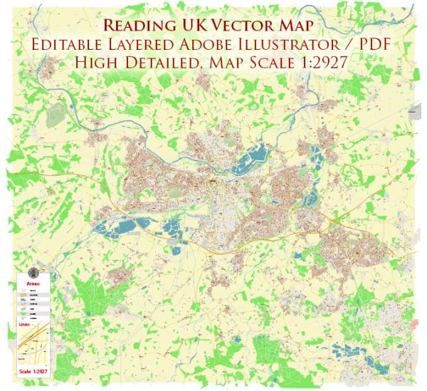
Reading is a historic town in Berkshire, England, with a rich heritage and a variety of waterways, bridges, and main streets. Vectormap.Net provide you with the most accurate and up-to-date vector maps in Adobe Illustrator, PDF and other formats, designed for editing and printing. Please read the vector map descriptions carefully.
Waterways:
- River Thames: The River Thames runs to the north of Reading, and it is one of the most significant waterways in the area. The river is navigable and has played a crucial role in the town’s history.
- Kennet and Avon Canal: This canal runs through Reading, connecting the River Thames to the River Kennet. It provides a scenic route for boating and is surrounded by picturesque landscapes.
Bridges:
- Reading Bridge: This is a historic bridge that spans the River Thames, connecting the town center to the area of Caversham. It has undergone several reconstructions over the years.
- Caversham Bridge: Another important bridge crossing the Thames, linking Reading to the suburb of Caversham.
- Christchurch Bridge: This is a more modern bridge that connects Reading with the Christchurch Meadows area.
Main Streets and Areas:
- Broad Street: This is one of Reading’s primary shopping streets, located in the town center. It features a mix of shops, restaurants, and historic buildings.
- Oracle Shopping Centre: A large shopping and leisure complex located by the riverside, offering a wide range of shops, restaurants, and entertainment options.
- King’s Road: A significant road that runs through the town center, hosting various shops, offices, and services.
- Friar Street: Another notable street in the town center, known for its historic architecture and a variety of shops and eateries.
- Caversham: Located across the River Thames, Caversham is a suburb of Reading with its own shopping areas and community spaces.
- Forbury Gardens: A beautiful public park in the town center, providing a green space for relaxation and events.
- London Street: A road that leads towards the east of the town center, hosting a mix of residential and commercial properties.
Please note that Reading has a network of streets and neighborhoods, and the ones mentioned here are just a few examples. Additionally, the town is subject to development and changes, so it’s always a good idea to check for the latest information if you need the most up-to-date details.


 Author: Kirill Shrayber, Ph.D. FRGS