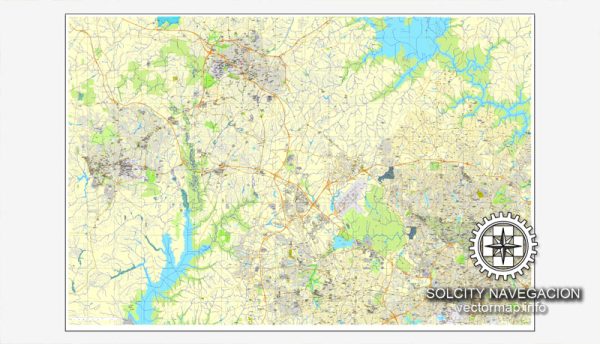
Raleigh, Chapel Hill, and Durham are three cities in the Research Triangle region of North Carolina, USA. Each city has its own unique characteristics, and they are connected by a network of roads and waterways. Here’s a brief description of the principal waterways, bridges, and main streets in each city:
Raleigh:
Waterways:
- Neuse River: The Neuse River flows through the eastern part of Raleigh, offering recreational opportunities and scenic views.
Bridges:
- Capital Boulevard Bridge: This bridge spans the Neuse River and connects downtown Raleigh with the northern parts of the city.
Main Streets:
- Fayetteville Street: A historic street in downtown Raleigh, known for its shops, restaurants, and cultural venues.
- Glenwood Avenue: A major thoroughfare with a mix of commercial and residential areas, featuring various dining and entertainment options.
Chapel Hill:
Waterways:
- Bolin Creek: A small creek that runs through Chapel Hill, offering green spaces and walking trails.
Bridges:
- Franklin Street Bridge: Spanning Bolin Creek, this bridge is a part of Franklin Street, a prominent thoroughfare in Chapel Hill.
Main Streets:
- Franklin Street: The heart of downtown Chapel Hill, known for its vibrant atmosphere, diverse shops, and restaurants, as well as its connection to the University of North Carolina at Chapel Hill.
Durham:
Waterways:
- Eno River: The Eno River runs through Durham, providing opportunities for outdoor activities and nature exploration.
Bridges:
- Duke Street Bridge: Crossing the Eno River, this bridge is an important link between downtown Durham and the northern parts of the city.
Main Streets:
- Main Street: Located in downtown Durham, Main Street is home to a variety of businesses, including restaurants, galleries, and cultural venues.
- Ninth Street: A popular area near Duke University, known for its eclectic mix of shops, cafes, and restaurants.
These descriptions provide a snapshot of the principal waterways, bridges, and main streets in Raleigh, Chapel Hill, and Durham. Vectormap.Net provide you with the most accurate and up-to-date vector maps in Adobe Illustrator, PDF and other formats, designed for editing and printing. Please read the vector map descriptions carefully.


 Author: Kirill Shrayber, Ph.D. FRGS