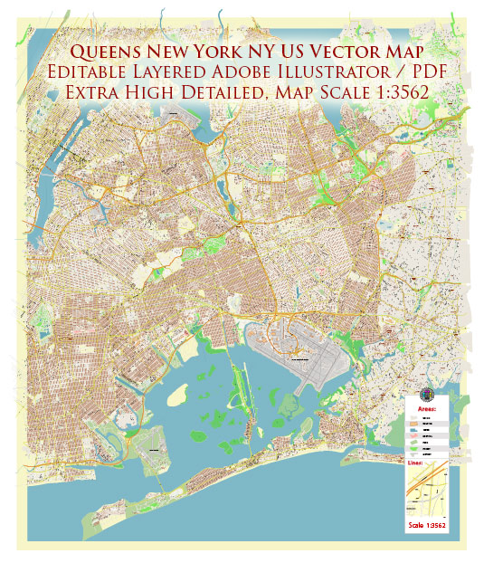
Queens, one of the five boroughs of New York City, is characterized by a diverse landscape of residential neighborhoods, commercial areas, and cultural hubs. Several waterways, bridges, and main streets define the borough’s geography and connectivity.
Waterways:
- East River: Queens is bounded to the west by the East River, separating it from Manhattan. The river serves as a vital waterway for transportation and offers stunning views of the Manhattan skyline.
- Flushing Bay: Located to the north of Queens, Flushing Bay is an estuary that connects to the East River. It is an essential part of the area’s waterfront.
- Jamaica Bay: To the south of Queens, Jamaica Bay is a large body of water with marshes and islands. It is a significant natural area that provides habitat for diverse wildlife.
Bridges:
- Queensboro Bridge (59th Street Bridge): Connecting Long Island City in Queens to the Upper East Side of Manhattan, this iconic cantilever bridge spans the East River.
- Triborough Bridge (Robert F. Kennedy Bridge): This complex of three bridges connects Queens, Manhattan, and the Bronx, spanning the East River and Harlem River.
- Throgs Neck Bridge: Connecting Queens to the Bronx over the East River, this suspension bridge is a vital transportation link in the area.
- Bronx-Whitestone Bridge: Spanning the East River, this suspension bridge connects the Bronx and Queens.
- Cross Bay Veterans Memorial Bridge: This bridge spans Jamaica Bay, connecting the neighborhoods of Broad Channel and the Rockaways.
Main Streets:
- Queens Boulevard: Known as the “Boulevard of Death” due to its history of traffic accidents, Queens Boulevard is a major thoroughfare running from Long Island City to Jamaica.
- Northern Boulevard: This east-west street passes through neighborhoods like Long Island City, Astoria, Jackson Heights, and Flushing, offering a mix of residential and commercial areas.
- Roosevelt Avenue: Running through neighborhoods like Jackson Heights and Flushing, Roosevelt Avenue is a bustling street known for its diverse shops, restaurants, and cultural events.
- Astoria Boulevard: Connecting Astoria and East Elmhurst, Astoria Boulevard is a key route with a mix of residential and commercial establishments.
- Jamaica Avenue: Running through the heart of Jamaica, this street is a major commercial and retail corridor with shops, restaurants, and cultural attractions.
Queens is a dynamic borough with a rich tapestry of communities, and its waterways, bridges, and main streets play a crucial role in shaping its identity and facilitating movement within the city.
Vectormap.Net provide you with the most accurate and up-to-date vector maps in Adobe Illustrator, PDF and other formats, designed for editing and printing. Please read the vector map descriptions carefully.


 Author: Kirill Shrayber, Ph.D. FRGS