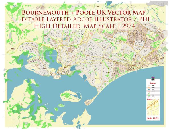
Some general information about the waterways, bridges, and main streets in the Poole and Bournemouth area in the UK. Vectormap.Net provide you with the most accurate and up-to-date vector maps in Adobe Illustrator, PDF and other formats, designed for editing and printing. Please read the vector map descriptions carefully.
Poole:
- Poole Harbour: Poole is well-known for its large natural harbor, Poole Harbour, which is one of the largest natural harbors in the world. It is a significant waterway that accommodates commercial, leisure, and ferry traffic.
- Twin Sails Bridge: The Twin Sails Bridge is a notable bridge in Poole that spans the Backwater Channel of Poole Harbour. It is a lifting bridge with distinctive triangular lifting leaves.
- Poole Quay: This area along the waterfront is a popular attraction with historic buildings, shops, and restaurants. It’s a hub of activity and a starting point for boat trips.
- The Quay Bridge: This is a bascule bridge that connects Poole Quay to the town center, crossing over the entrance to the town’s Inner Harbour.
Bournemouth:
- Bournemouth Pier: Bournemouth has a prominent pier extending into the English Channel. The pier is a popular spot for tourists and offers various entertainment options.
- Bournemouth Beach: While not a waterway or bridge, Bournemouth’s long sandy beach is a key feature, attracting locals and tourists for recreational activities.
- Bournemouth Gardens: This is a stretch of landscaped gardens running through the town center. It’s not a waterway, but it provides a green space in the urban environment.
- A35 Wessex Way: This major road runs through Bournemouth and connects with the A31, providing important transport links.
Please note that urban developments, infrastructure projects, and changes to roads or waterways can occur, so it’s advisable to check with local sources or the latest maps for the most up-to-date information on the Poole and Bournemouth area.


 Author: Kirill Shrayber, Ph.D.