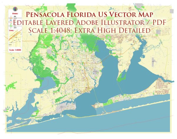
A general overview of the principal waterways, bridges, and main streets in Pensacola, Florida. Vectormap.Net provide you with the most accurate and up-to-date vector maps in Adobe Illustrator, PDF and other formats, designed for editing and printing. Please read the vector map descriptions carefully.
Waterways:
- Pensacola Bay: This is a natural bay located in the western part of the Florida Panhandle. It is an inlet of the Gulf of Mexico and provides access to the Gulf through a narrow passage known as the Pensacola Pass.
- Escambia River: The Escambia River flows into Pensacola Bay and is an important watercourse in the region.
- Bayou Texar: A scenic bayou that flows through parts of Pensacola, offering waterfront views and recreational opportunities.
Bridges:
- Three-Mile Bridge (Pensacola Bay Bridge): This bridge spans Pensacola Bay, connecting the city of Pensacola to Gulf Breeze.
- Bob Sikes Bridge: This bridge connects Gulf Breeze to Santa Rosa Island, providing access to the popular destination of Pensacola Beach.
- Garcon Point Bridge: Located to the east of Pensacola, this toll bridge connects U.S. Route 98 to Garcon Point.
Main Streets:
- Palafox Street: Palafox Street is one of the main streets in downtown Pensacola. It is known for its historic architecture, shops, restaurants, and cultural attractions.
- Cervantes Street: Another important thoroughfare in Pensacola, Cervantes Street runs through various neighborhoods and commercial areas.
- Davis Highway (U.S. Route 90): Davis Highway is a major road that runs through Pensacola, connecting the downtown area to the northern parts of the city.
- Bayfront Parkway (U.S. Route 98): This road runs along the waterfront, offering scenic views of the bay and providing access to various attractions.
Please note that developments or changes in infrastructure may have occurred since my last update, and it’s recommended to check with local sources or authorities for the most current information on waterways, bridges, and main streets in Pensacola, Florida.


 Author: Kirill Shrayber, Ph.D.