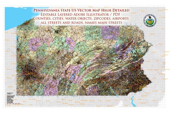
Pennsylvania, located in the northeastern and Mid-Atlantic regions of the United States, is known for its diverse geography, vibrant cities, and rich history. Here’s a brief description of some of the principal cities, waterways, and main roads in the state:
Principal Cities:
- Philadelphia:
- The largest city in Pennsylvania and the sixth-largest city in the U.S.
- Known for its historical significance, including Independence Hall and the Liberty Bell.
- Major cultural attractions, museums, and a thriving arts scene.
- Pittsburgh:
- Located in the western part of the state, known as the “Steel City.”
- Has a rich industrial history and is home to numerous museums and cultural institutions.
- Famous for its three rivers: the Allegheny, Monongahela, and Ohio.
- Harrisburg:
- The capital city of Pennsylvania, situated along the Susquehanna River.
- Houses the Pennsylvania State Capitol and various government buildings.
- Allentown:
- Located in the Lehigh Valley, it is one of the fastest-growing cities in the state.
- Known for its historic architecture and cultural events.
- Erie:
- On the shores of Lake Erie, it is known for Presque Isle State Park and its maritime history.
- A significant port city with connections to the Great Lakes.
Waterways:
- Susquehanna River:
- One of the longest rivers in the U.S., flowing through central Pennsylvania.
- Harrisburg, the state capital, is situated along the Susquehanna.
- Delaware River:
- Forms the eastern border of Pennsylvania, separating it from New Jersey.
- Philadelphia is located along the Delaware River.
- Ohio River:
- Marks the western border of the state, separating it from Ohio.
- Pittsburgh is situated at the confluence of the Allegheny and Monongahela Rivers, forming the Ohio River.
Main Roads:
- Interstate 76 (I-76) – Pennsylvania Turnpike:
- A major east-west highway connecting Philadelphia and Pittsburgh.
- Interstate 95 (I-95):
- Runs along the eastern border, connecting major cities like Philadelphia and providing access to the East Coast.
- Interstate 79 (I-79):
- Runs north-south through western Pennsylvania, connecting Pittsburgh and Erie.
- U.S. Route 22 (US 22):
- An east-west highway connecting Pittsburgh and the eastern part of the state.
- U.S. Route 30 (US 30) – Lincoln Highway:
- Historic transcontinental highway connecting Philadelphia and Pittsburgh.
- Pennsylvania Route 611 (PA 611):
- Runs through eastern Pennsylvania, connecting Philadelphia and the Pocono Mountains.
Pennsylvania’s transportation network is extensive, facilitating both regional and interstate travel, and its cities offer a mix of history, culture, and economic activity.
Vectormap.Net provide you with the most accurate and up-to-date vector maps in Adobe Illustrator, PDF and other formats, designed for editing and printing. Please read the vector map descriptions carefully.


 Author: Kirill Shrayber, Ph.D. FRGS