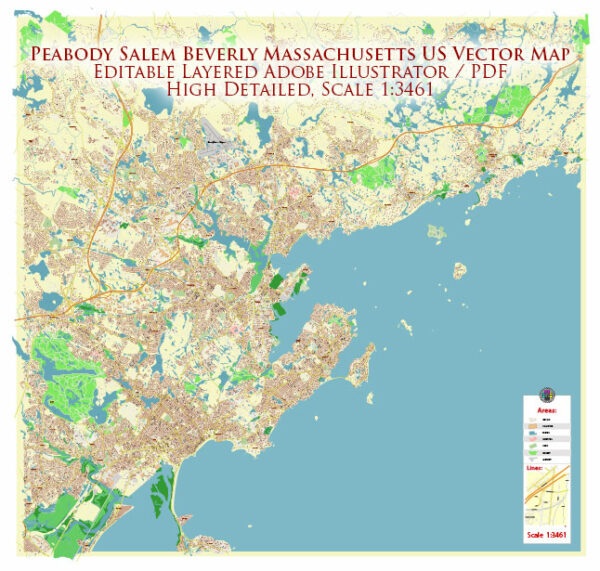
Peabody, Salem, and Beverly are cities in the state of Massachusetts, USA. Each city has its own unique features when it comes to waterways, bridges, and main streets. Vectormap.Net provide you with the most accurate and up-to-date vector maps in Adobe Illustrator, PDF and other formats, designed for editing and printing. Please read the vector map descriptions carefully.
Peabody, Massachusetts:
Waterways:
- North River: Flows through Peabody, providing a natural water feature.
Bridges:
- Main Street Bridge: Connects different parts of the city over North River.
Main Streets and Roads:
- Main Street: As the name suggests, it is a prominent road in Peabody, likely hosting various shops and businesses.
- Lowell Street: Another significant road in the city.
Salem, Massachusetts:
Waterways:
- North River: Also flows through Salem, as it is a neighboring city to Peabody.
Bridges:
- Beverly/Salem Bridge: Connects Salem to Beverly over the Danvers River.
Main Streets and Roads:
- Essex Street: A historic and vibrant street in downtown Salem with numerous shops and attractions.
- Washington Street: Another major thoroughfare in the city.
Beverly, Massachusetts:
Waterways:
- Danvers River: Flows through Beverly, providing a scenic waterfront.
Bridges:
- Beverly/Salem Bridge: Connecting Beverly to Salem.
Main Streets and Roads:
- Cabot Street: A central street in Beverly with various businesses and cultural attractions.
- Rantoul Street: Another significant road in the city.
These descriptions provide a general overview, and the specific details may vary. For the most accurate and up-to-date information, it’s recommended to check with local sources or city planning departments. City websites, maps, and local community resources can also offer detailed information about waterways, bridges, and main streets in each location.


 Author: Kirill Shrayber, Ph.D. FRGS