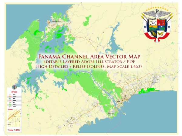
The Panama Canal area is a vital and strategically important region connecting the Atlantic and Pacific Oceans. The primary cities, waterways, and main roads in the Panama Canal area include:
Principal Cities:
- Panama City:
- The capital and largest city of Panama.
- Located on the Pacific Ocean side of the country.
- A major financial and cultural hub.
- Colón:
- Situated on the Caribbean Sea side.
- Adjacent to the Atlantic entrance of the Panama Canal.
- A key port city.
Waterways:
- Panama Canal:
- An artificial waterway that connects the Atlantic and Pacific Oceans.
- It cuts across the Isthmus of Panama, facilitating maritime trade and reducing the need for lengthy voyages around South America.
Main Roads:
- Pan-American Highway:
- A network of roads that stretches across the Americas, connecting the northern and southern continents.
- In Panama, it serves as a major transportation artery.
- Transístmica Highway:
- Connects Panama City on the Pacific side to Colón on the Atlantic side.
- An important road for transporting goods and people between the two coasts.
- Corredor Sur and Corredor Norte:
- Modern toll highways that connect different parts of Panama City.
- Corredor Sur runs southward from the city, while Corredor Norte extends to the northern suburbs.
- Avenida Balboa:
- A major avenue in Panama City located along the Pacific Ocean coastline.
- Features parks, shopping areas, and modern skyscrapers.
Notable Geographical Features:
- Gatun Lake:
- An artificial lake that forms a crucial part of the Panama Canal.
- The Gatun Dam created this lake, and it helps regulate the water levels of the canal.
- Miraflores and Pedro Miguel Locks:
- Two of the locks along the Panama Canal that facilitate the elevation changes necessary for ships to traverse the canal.
- Barro Colorado Island:
- An island in Gatun Lake that serves as a biological reserve, known for its diverse flora and fauna.
The Panama Canal area is of immense global importance due to its role in international trade and transportation, and the infrastructure surrounding it plays a crucial role in supporting these activities.
Vectormap.Net provide you with the most accurate and up-to-date vector maps in Adobe Illustrator, PDF and other formats, designed for editing and printing. Please read the vector map descriptions carefully.


 Author: Kirill Shrayber, Ph.D.