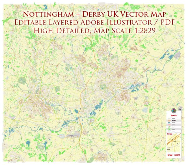
Nottingham and Derby are two cities in the East Midlands of England, and while they are separate entities, they are relatively close to each other. Here’s a brief overview of their principal waterways, bridges, and main streets:
Nottingham:
- River Trent: The River Trent is the most significant waterway in Nottingham. It flows through the city, providing a picturesque setting for various activities. There are several bridges spanning the River Trent in Nottingham.
- Trent and Mersey Canal: This canal passes through Nottingham and is an important waterway for both transportation and leisure activities. It connects the River Trent to the Mersey estuary.
- Bridges: Some notable bridges in Nottingham include Trent Bridge, Wilford Suspension Bridge, and Clifton Bridge. Trent Bridge is particularly famous and has a historical significance in the city.
- Main Streets: Nottingham’s city center is characterized by a network of streets that include Market Square, Old Market Square, and the Lace Market area. Streets like Long Row and Parliament Street are major shopping areas.
Derby:
- River Derwent: The River Derwent is the primary watercourse flowing through Derby. It adds to the city’s scenic beauty and has played a role in its industrial history.
- Derby Canal: While not as prominent as the River Derwent, the Derby Canal has historical significance in the city. Parts of the canal have been restored for leisure use.
- Bridges: Some notable bridges in Derby include Exeter Bridge and St. Alkmund’s Way Bridge. These bridges connect different parts of the city and provide important transportation links.
- Main Streets: Derby’s city center features streets like Iron Gate and Cornmarket, which are popular for shopping and dining. The Cathedral Quarter is known for its historical architecture and cultural attractions.
Both cities have undergone urban development, and their waterways, bridges, and streets contribute to the overall character of each. Nottingham and Derby are well-connected by road and rail, making it easy for residents and visitors to explore the diverse offerings of both cities and the surrounding East Midlands region.
Vectormap.Net provide you with the most accurate and up-to-date vector maps in Adobe Illustrator, PDF and other formats, designed for editing and printing. Please read the vector map descriptions carefully.


 Author: Kirill Shrayber, Ph.D.