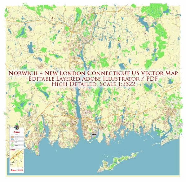
Norwich and New London are neighboring cities in southeastern Connecticut, and both are located along the Thames River. Here’s an overview of the principal waterways, bridges, and main streets and roads in these two cities:
Norwich, Connecticut:
Waterways:
- Thames River: The Thames River flows through the western part of Norwich, providing a scenic waterfront. It has historical significance and was an important transportation route in the past.
Bridges:
- Uncas Leap Heritage Area: While not a bridge, the Uncas Leap Heritage Area features the Yantic Falls and a historical marker commemorating the legendary leap of the Mohegan chief Uncas.
Main Streets and Roads:
- Main Street: Norwich has a Main Street that runs through the downtown area, featuring a mix of historic buildings and modern amenities.
- Route 2: A major state route that passes through Norwich, connecting it to other towns and cities in Connecticut.
New London, Connecticut:
Waterways:
- Thames River: Similar to Norwich, New London is situated along the Thames River, which flows through the city and plays a significant role in its maritime history.
Bridges:
- Gold Star Memorial Bridge: This bridge connects New London to Groton, spanning the Thames River. It’s a vital transportation link in the region.
Main Streets and Roads:
- Bank Street: Bank Street is a prominent street in downtown New London, known for its shops, restaurants, and historic architecture.
- U.S. Route 1: Also known as the Boston Post Road, Route 1 passes through New London and connects it to other towns and cities along the East Coast.
- I-95: The city is accessible via Interstate 95, a major north-south highway that runs along the eastern seaboard.
Shared Features:
- Both cities are part of the southeastern region of Connecticut and are connected by the Thames River.
- The Thames River is navigable, and historically, it has been a significant waterway for trade and transportation.
- The cities have a mix of historic and modern architecture, reflecting their rich history.
Vectormap.Net provide you with the most accurate and up-to-date vector maps in Adobe Illustrator, PDF and other formats, designed for editing and printing. Please read the vector map descriptions carefully.


 Author: Kirill Shrayber, Ph.D. FRGS