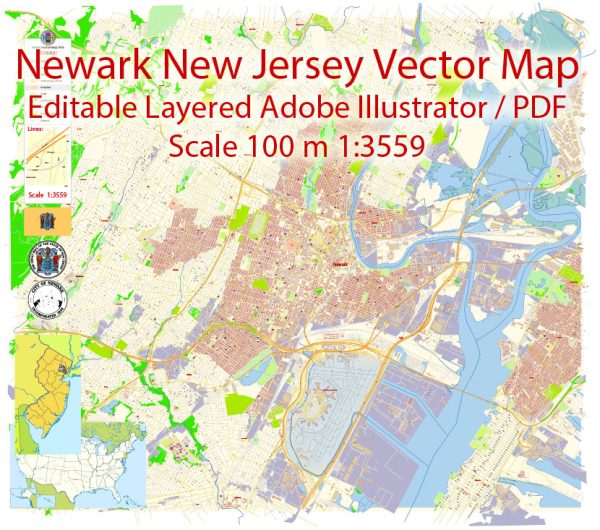
A general information about Newark, New Jersey’s principal waterways, bridges, and main streets. Vectormap.Net provide you with the most accurate and up-to-date vector maps in Adobe Illustrator, PDF and other formats, designed for editing and printing. Please read the vector map descriptions carefully.
Principal Waterways:
- Passaic River: The Passaic River flows through Newark, playing a significant role in the city’s geography and history.
Bridges:
- Pulaski Skyway: Connecting Newark to Jersey City and Kearny, the Pulaski Skyway is a notable elevated bridge.
- New Jersey Turnpike (I-95): The Newark Bay Extension of the New Jersey Turnpike includes several bridges and connects Newark to the New Jersey Turnpike mainline.
- Market Street Bridge: This is a bascule bridge spanning the Passaic River, connecting Newark to Harrison.
Main Streets:
- Broad Street: One of Newark’s primary thoroughfares, Broad Street runs through the heart of downtown Newark and is lined with various shops, businesses, and cultural institutions.
- Market Street: Another important street in Newark, Market Street intersects with Broad Street and is home to a variety of businesses and historic sites.
- Raymond Boulevard: This boulevard runs parallel to the Passaic River and is known for its scenic views and proximity to various attractions.
- McCarter Highway (Route 21): This highway runs through Newark, providing access to various neighborhoods and connecting to major routes in the region.
Please note that Newark has a comprehensive street grid, and there are many other streets contributing to the city’s transportation network. Additionally, ongoing urban development projects might have influenced the city’s infrastructure since my last update. For the latest and most accurate information, consider checking with local authorities or using online mapping services.


 Author: Kirill Shrayber, Ph.D.