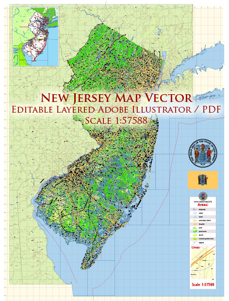
Information about New Jersey’s principal cities, waterways, and main roads. Vectormap.Net provide you with the most accurate and up-to-date vector maps in Adobe Illustrator, PDF and other formats, designed for editing and printing. Please read the vector map descriptions carefully.
Principal Cities in New Jersey:
- Newark: Located in the northern part of the state, Newark is the largest city in New Jersey and a major transportation hub.
- Jersey City: Situated along the Hudson River across from Lower Manhattan, Jersey City is known for its waterfront development and proximity to New York City.
- Trenton: The capital city of New Jersey, Trenton is located in the central part of the state along the Delaware River.
- Paterson: Located in the northeastern part of the state, Paterson is known for its industrial history, including textile and silk production.
- Elizabeth: Situated in Union County, Elizabeth is one of the state’s oldest cities and a transportation hub.
- Edison: Located in Middlesex County, Edison is known for its diverse population and is a major retail and commercial center.
Waterways:
- Delaware River: Forms the western border of New Jersey, separating it from Pennsylvania.
- Hudson River: Forms part of the eastern border, separating New Jersey from New York.
- Atlantic Ocean: Borders the eastern part of the state, providing coastal areas and beaches.
- Raritan River: Flows through central New Jersey, passing near the city of New Brunswick before emptying into Raritan Bay.
- Passaic River: Flows through northern New Jersey, passing through cities like Paterson and Newark before emptying into Newark Bay.
Main Roads and Highways:
- New Jersey Turnpike (I-95): A major toll highway running north-south through the state, connecting to major cities along the East Coast.
- Garden State Parkway: A toll road running north-south along the eastern part of the state, providing access to coastal areas.
- Interstate 78 (I-78): Runs east-west across northern New Jersey, connecting to Pennsylvania in the west and the Holland Tunnel to New York City in the east.
- Interstate 80 (I-80): Another major east-west highway, running across the northern part of the state.
- U.S. Route 1: A major north-south highway connecting many cities and towns in central New Jersey.
- U.S. Route 9: Runs north-south along the eastern part of the state, connecting many suburban communities.
Please note that roadways and city developments can change, so it’s always a good idea to check for the latest information and maps for the most accurate details.


 Author: Kirill Shrayber, Ph.D. FRGS