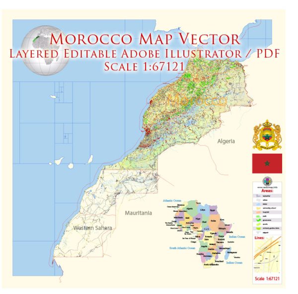
Morocco is a country located in North Africa, known for its diverse landscapes, rich history, and vibrant culture. Here is a description of some of its principal cities, waterways, and main roads:
Principal Cities:
- Rabat: The capital city of Morocco, located on the Atlantic Ocean. It is known for its historic sites, including the Kasbah of the Udayas and the Hassan Tower.
- Casablanca: The largest city in Morocco and a major economic hub. Casablanca is situated on the Atlantic coast and is famous for its modern architecture, including the Hassan II Mosque.
- Marrakech: A popular tourist destination, Marrakech is known for its vibrant markets, historic medina, and the iconic Jardin Majorelle. The city is located in the interior of the country.
- Fez: One of the oldest and most well-preserved medieval cities in the world, Fez is known for its ancient medina, colorful souks, and historic mosques.
- Tangier: Situated at the northern tip of Morocco, Tangier is a port city overlooking the Strait of Gibraltar. It has a unique blend of European and Moroccan influences.
Waterways:
- Atlantic Ocean: Morocco has a significant coastline along the Atlantic Ocean to the west, providing the country with important ports such as Casablanca and Agadir.
- Mediterranean Sea: The northern coastline of Morocco is along the Mediterranean Sea, with cities like Tangier and Nador having access to this important body of water.
- Strait of Gibraltar: This narrow strait separates Morocco from Spain and connects the Mediterranean Sea to the Atlantic Ocean. It is a crucial maritime passage.
Main Roads:
- N1 (National Route 1): This is a major north-south highway connecting Tangier in the north to Agadir in the south, passing through cities like Rabat and Casablanca.
- N9 (National Route 9): Running east-west, this highway connects Marrakech to Ouarzazate and serves as a key route for accessing the Sahara Desert.
- N13 (National Route 13): Connecting the cities of Fez and Oujda in the northeast, this road is important for transportation in the eastern part of the country.
- A3 (Autoroute 3): Commonly known as the Rabat-Casablanca highway, it is a modern toll road that facilitates rapid transit between the two major cities.
These are just a few examples, and Morocco has an extensive road network that connects various regions and facilitates transportation across the country.
Vectormap.Net provide you with the most accurate and up-to-date vector maps in Adobe Illustrator, PDF and other formats, designed for editing and printing. Please read the vector map descriptions carefully.


 Author: Kirill Shrayber, Ph.D. FRGS