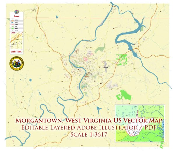
Morgantown, West Virginia, is a city situated along the banks of the Monongahela River. The city is known for its picturesque landscape and is home to West Virginia University. Here is a brief description of some of the principal waterways, bridges, and main streets in Morgantown:
Waterways:
- Monongahela River: The Monongahela River flows along the western edge of Morgantown. It is a major tributary of the Ohio River and an essential waterway for the region.
Bridges:
- Westover Bridge: This bridge spans the Monongahela River, connecting Morgantown with the neighboring town of Westover. It is a vital transportation link for residents and visitors.
- High Street Bridge: Also known as the Walnut Street Bridge, it connects the downtown area of Morgantown with the West Virginia University campus. This bridge is a key route for pedestrians and vehicles.
- Star City Bridge: Situated to the north of Morgantown, this bridge provides another crossing over the Monongahela River, linking Morgantown with the town of Star City.
Main Streets:
- High Street: Running through the heart of downtown Morgantown, High Street is a bustling thoroughfare lined with shops, restaurants, and businesses. It is a central hub for both residents and students.
- Beechurst Avenue: This street is significant as it runs adjacent to the West Virginia University campus. It is home to various university buildings, student housing, and amenities.
- University Avenue: Connecting downtown Morgantown with the WVU Evansdale Campus, University Avenue is an important route for students and faculty.
- Don Knotts Boulevard: Named after the famous actor and Morgantown native, Don Knotts Boulevard is a major roadway in the city, providing access to various neighborhoods and commercial areas.
Morgantown’s layout is influenced by the river and the presence of West Virginia University, making these waterways, bridges, and streets integral parts of the city’s infrastructure and character. Vectormap.Net provide you with the most accurate and up-to-date vector maps in Adobe Illustrator, PDF and other formats, designed for editing and printing. Please read the vector map descriptions carefully.


 Author: Kirill Shrayber, Ph.D.