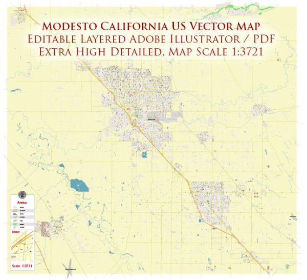
Modesto, California, is located in the Central Valley and is known for its agricultural roots. While it doesn’t have major waterways like some other cities, it is situated near the Tuolumne River, which runs to the north of the city. Additionally, there are several irrigation canals in the surrounding agricultural areas.
Waterways:
- Tuolumne River: The Tuolumne River is the most significant waterway near Modesto. It flows to the north of the city and is a tributary of the San Joaquin River.
Bridges:
- Seventh Street Bridge: This bridge spans the Tuolumne River and connects the northern and southern parts of Modesto.
- Ninth Street Bridge: Another bridge crossing the Tuolumne River, providing additional connectivity within the city.
- Kansas Avenue Bridge: Located on the eastern side of Modesto, this bridge crosses one of the irrigation canals.
Main Streets:
- McHenry Avenue: McHenry Avenue is one of the main north-south thoroughfares in Modesto, known for its commercial and retail establishments.
- Carpenter Road: Running parallel to McHenry Avenue, Carpenter Road is another important north-south road in the eastern part of the city.
- Briggsmore Avenue: Running east-west, Briggsmore Avenue is a major arterial road connecting different neighborhoods and commercial areas.
- Standiford Avenue: Another east-west road, Standiford Avenue serves as a significant route through the city.
These are just a few examples, and Modesto has a grid-like street layout, making navigation relatively straightforward. Keep in mind that the city’s infrastructure may evolve, so it’s a good idea to check for the latest maps and information for the most accurate details.


 Author: Kirill Shrayber, Ph.D. FRGS