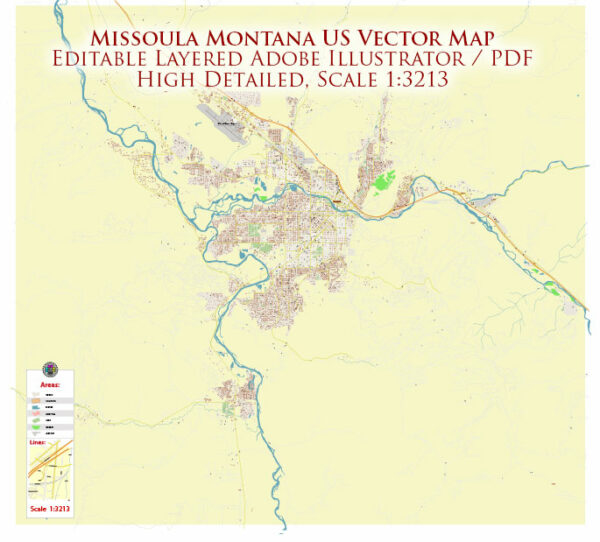
Missoula, located in western Montana, is situated along the Clark Fork River and is surrounded by scenic mountains. Here’s an overview of some of the principal waterways, bridges, and main streets in and around Missoula:
Principal Waterways:
- Clark Fork River:
- The Clark Fork River flows through the heart of Missoula, providing a picturesque backdrop to the city.
- It’s a popular spot for recreational activities such as fishing, kayaking, and tubing.
- Bitterroot River:
- The Bitterroot River, another significant waterway, converges with the Clark Fork just southwest of Missoula.
Bridges:
- Orange Street Bridge:
- This bridge spans the Clark Fork River, connecting the downtown area with the University District.
- It’s a key crossing for both pedestrians and vehicles.
- Van Buren Street Bridge:
- Located a bit upstream from the Orange Street Bridge, the Van Buren Street Bridge is another important crossing over the Clark Fork River.
Main Streets:
- Higgins Avenue:
- Higgins Avenue is a major north-south thoroughfare in downtown Missoula.
- It hosts a variety of shops, restaurants, and cultural attractions.
- Broadway Street:
- Broadway Street intersects with Higgins Avenue and runs east-west, providing access to the University of Montana campus.
- It’s a hub for university-related activities and businesses.
- Brooks Street:
- Running parallel to Higgins Avenue, Brooks Street is another important road that connects various neighborhoods and commercial areas.
- Reserve Street:
- Located on the western side of Missoula, Reserve Street is a major north-south corridor with a concentration of retail and commercial establishments.
- Front Street:
- Front Street runs along the Clark Fork River, offering scenic views and access to parks and trails.
Missoula’s layout is influenced by its natural surroundings, with the rivers and mountains contributing to the city’s unique character. The combination of outdoor recreational opportunities and a vibrant downtown make it a distinctive and appealing community. Keep in mind that urban developments may change over time, so it’s advisable to consult local sources for the latest information on infrastructure and landmarks.
Vectormap.Net provide you with the most accurate and up-to-date vector maps in Adobe Illustrator, PDF and other formats, designed for editing and printing. Please read the vector map descriptions carefully.


 Author: Kirill Shrayber, Ph.D. FRGS